
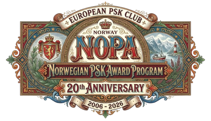
Official EPC award programme dedicated to the 20th Anniversary of the European PSK Club. This page presents the Norwegian award structure, the governing rules, and the official reference lists for counties, EU areas, and island groups.
The Norwegian PSK Award Program (NOPA) was established to sponsor a distinguished series of PSK awards based on the administrative geography and amateur radio activity of Norway. The programme is open to any licensed radio amateur, club station, or DMS (SWL) eligible under the EPC Awards General Rules who can produce acceptable evidence in the form of an ADIF log.
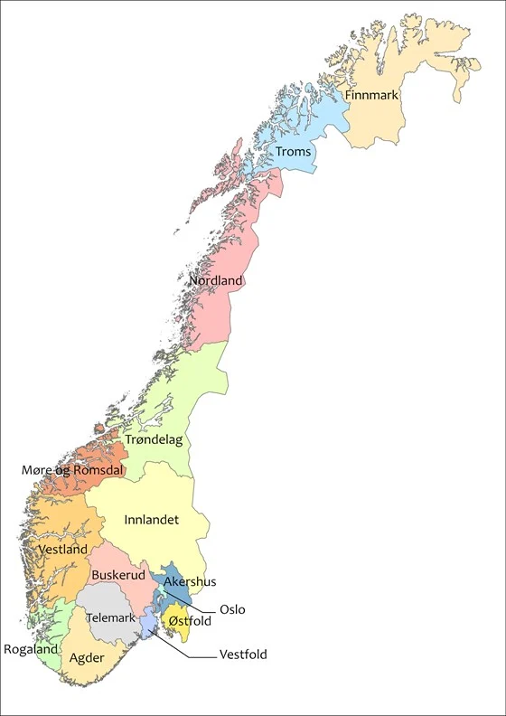
Qualifying contacts or monitored receptions must be made with amateur radio stations from Norway, including its integral overseas areas of Svalbard and Jan Mayen, and its dependent territories of Bouvet Island (Bouvetøya), Queen Maud Land, and Peter I Island. All PSK modes and baud rates are valid on any amateur radio bands below 54 MHz.
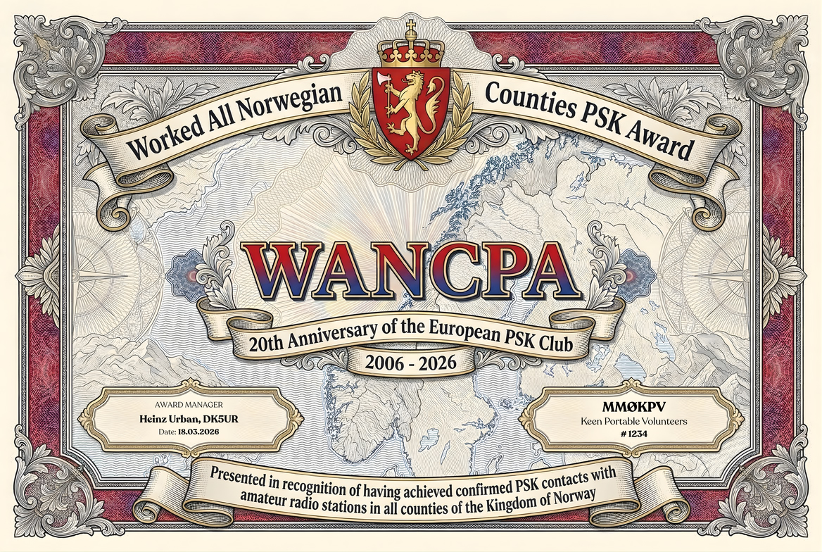
Issued for PSK QSOs with all the counties of the Kingdom of Norway, including the capital Oslo.
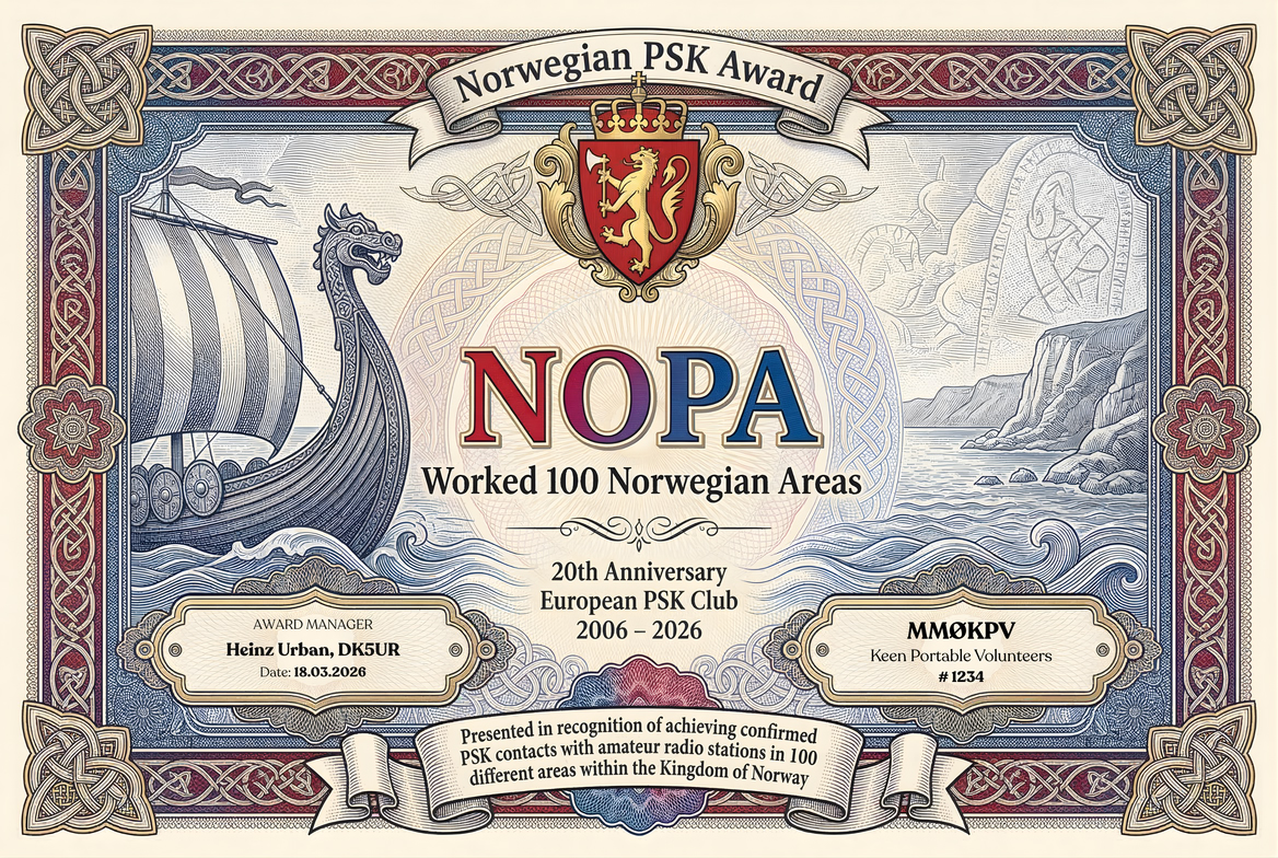
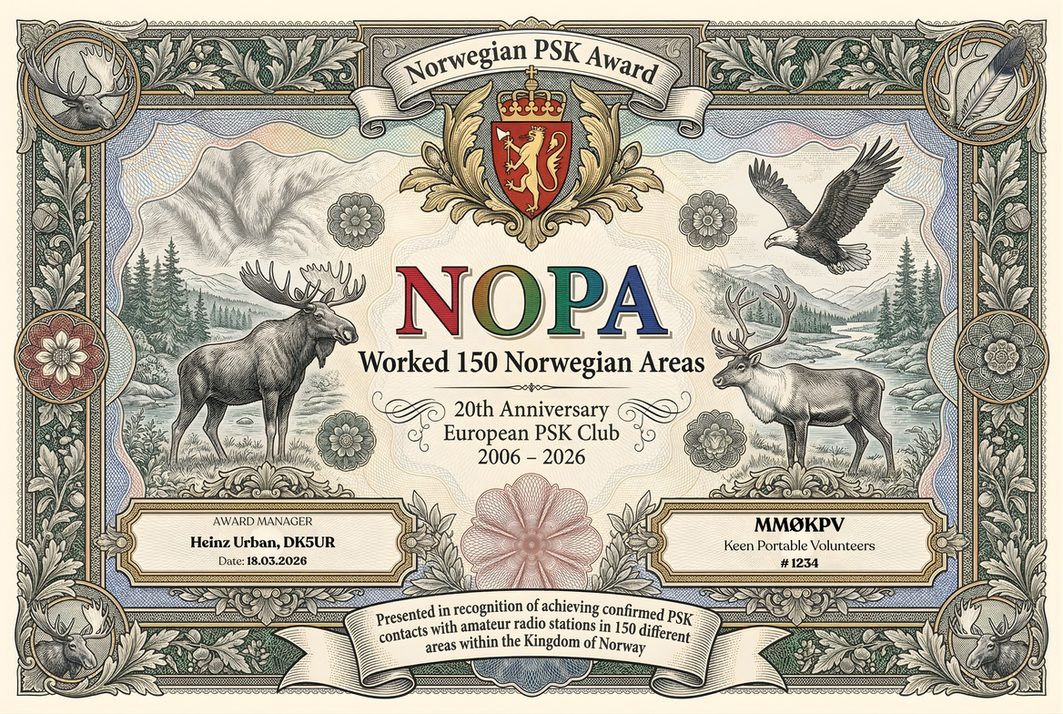
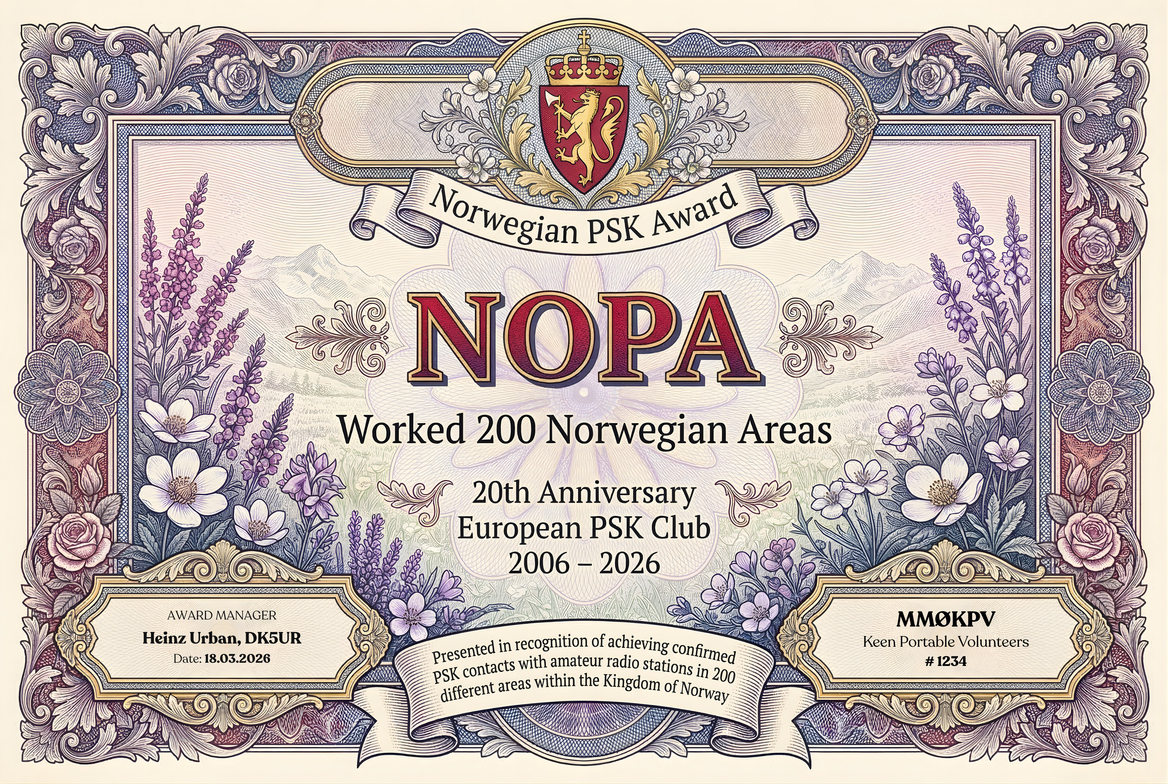
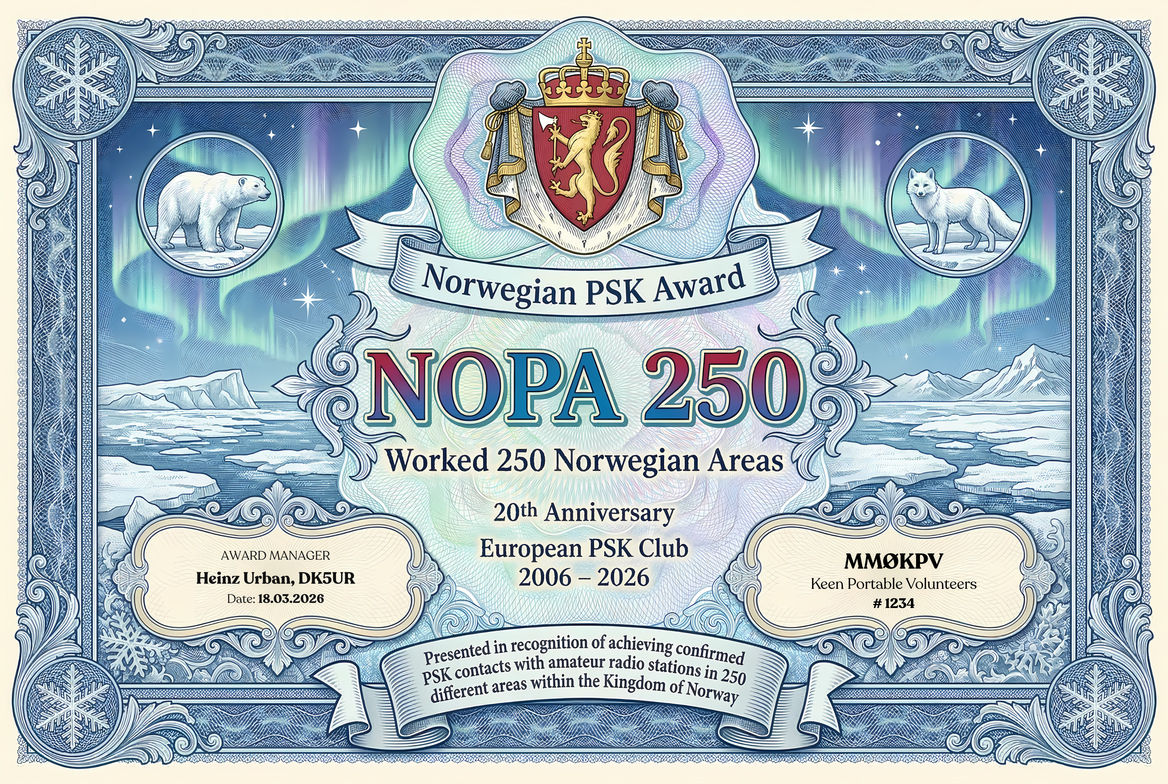
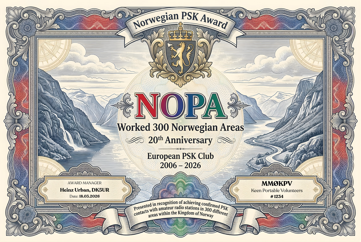
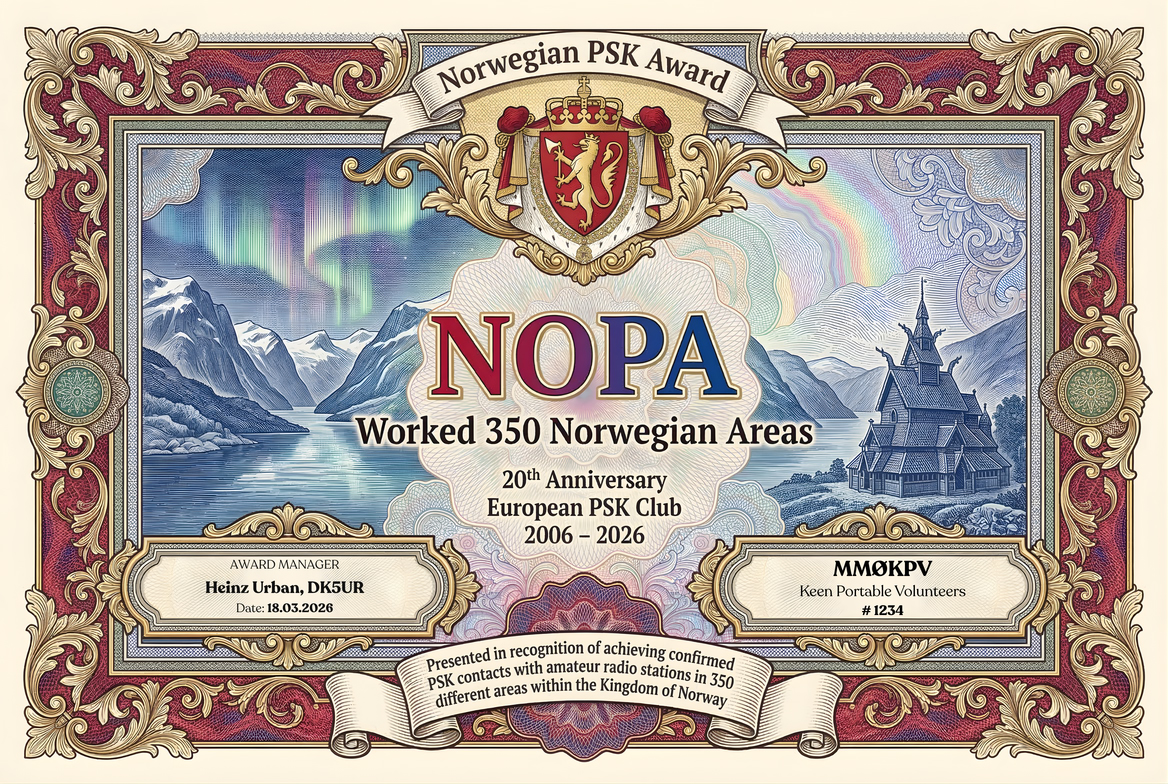
The Norwegian PSK Award Program is an official EPC award programme dedicated to the 20th Anniversary of the European PSK Club (2006–2026). Its purpose is to encourage PSK activity with Norway and to recognise confirmed achievement within a clearly defined geographic award structure.
Applications may be submitted by any licensed radio amateur, club station, or DMS (SWL) who is eligible under the EPC Awards General Rules. All applicants must comply fully with those general rules in addition to the present programme provisions.
Only contacts or monitored receptions with amateur radio stations from Norway qualify for credit. All PSK modes and baud rates are accepted. Qualifying activity may take place on any amateur radio band below 54 MHz.
Every application must be supported by an ADIF log. The submitted log must contain sufficient information for verification of callsign, date, band, mode, and award credit. Responsibility for the correctness and completeness of the submitted data rests entirely with the applicant.
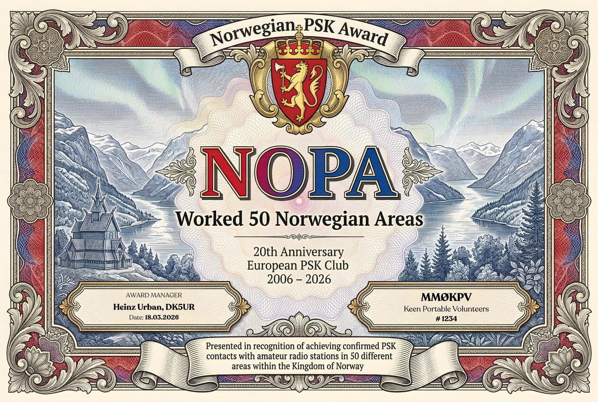
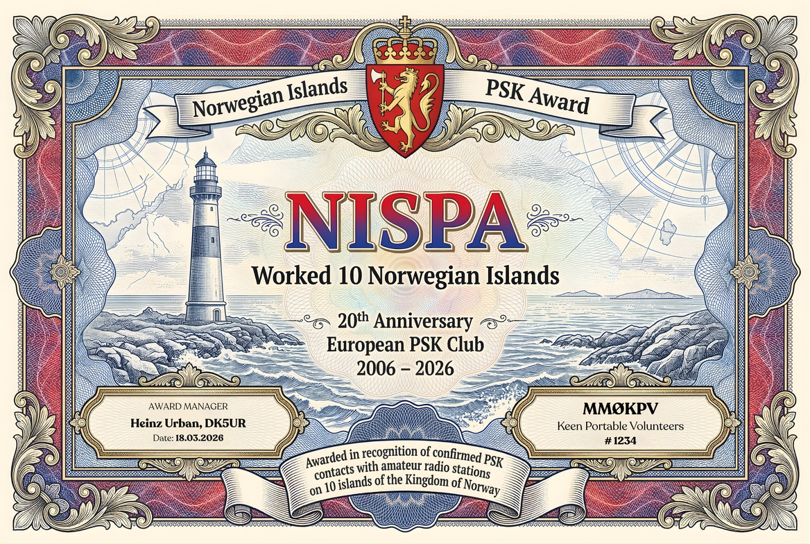
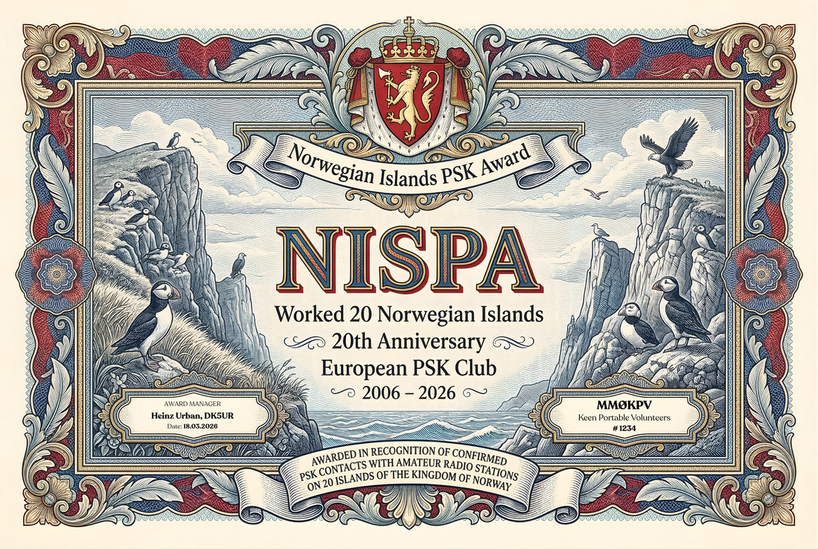
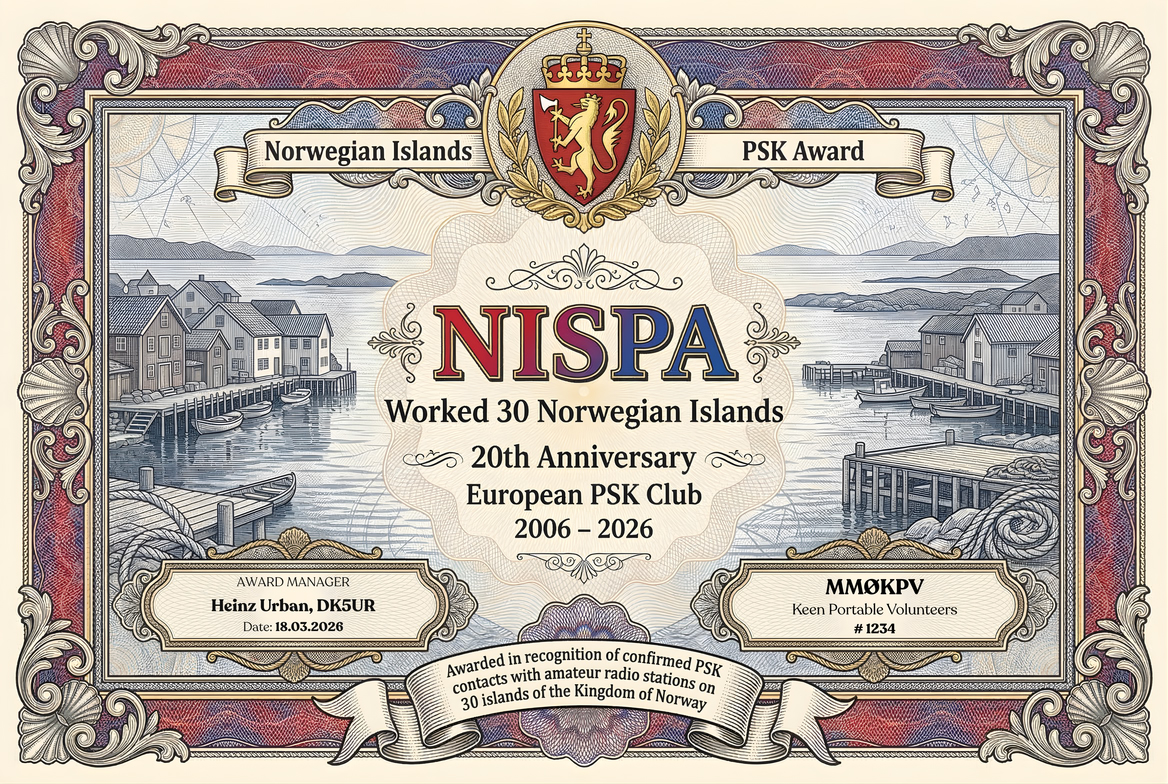
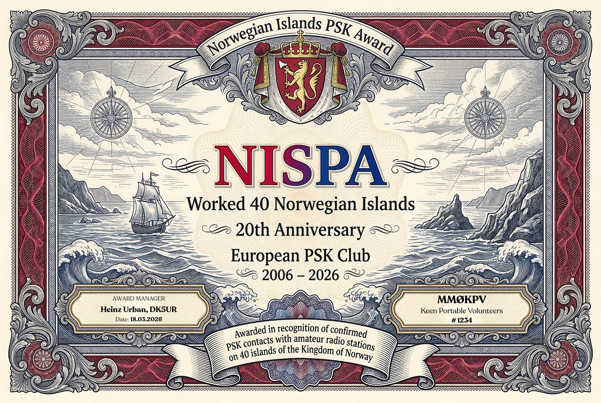
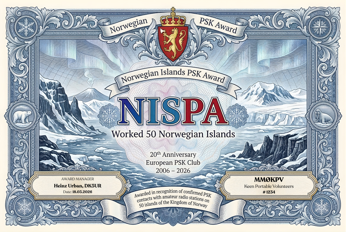
WANCPA credit is based on confirmed county coverage, including Oslo. NOPA credit is based on different official EPC EU areas within the Kingdom of Norway, with published levels of 50, 100, 150, 200, 250, 300, and 350 areas. NISPA credit is based on different recognised Norwegian island groups, with published levels of 10, 20, 30, 40, and 50 groups.
All area references shall follow the official EPC EU Areas List. The complete reference tables reproduced on this page are supplied for convenience. The award administration may request clarification or corrected log information where necessary, and reserves the right to interpret these rules and determine final credit.
The county award is issued for confirmed PSK QSOs with all counties of the Kingdom of Norway, including Oslo.
The complete Norwegian EPC area reference list is arranged below by territory and province. Use the search box to locate a municipality, borough, territory, or area code quickly.
Archipelago of Svalbard39 areas
| Prefix | Area | Norwegian name | Coordinates | EPC code |
|---|---|---|---|---|
| JW | Foreland National Park (Prince Charles Foreland) | Forlandet Nasjonalpark (Prins Karls Forland) | 78°33′00″N 11°07′00″E | NO.SV.FL |
| JW | Inner Wijdefjord National Park (Spitsbergen) | Indre Wijdefjorden Nasjonalpark | 79°00′00″N 16°00′00″E | NO.SV.IW |
| JW | North Isfjord National Park (Spitsbergen) | Nordre Isfjorden Nasjonalpark | 78°24′00″N 14°23′00″E | NO.SV.NI |
| JW | Northern Skiöld Land National Park (Spitsbergen) | Nordenskiöld Land Nasjonalpark | 77°52′00″N 15°19′00″E | NO.SV.NL |
| JW | Northwest Spitsbergen National Park | Nordvest-Spitsbergen Nasjonalpark | 79°35′00″N 11°30′00″E | NO.SV.NV |
| JW | Sassen-Bünsow National Park (Spitsbergen) | Sassen-Bünsow Land Nasjonalpark | 78°23′00″N 17°15′00″E | NO.SV.SB |
| JW | South Spitsbergen National Park | Sør-Spitsbergen National Park | 77°09′00″N 16°17′00″E | NO.SV.SS |
| Prefix | Area | Norwegian name | Coordinates | EPC code |
|---|---|---|---|---|
| JW | Bear Island Nature Reserve | Bjørnøya Naturreservat | 74°31′00″N 19°01′00″E | NO.SV.BJ |
| JW | Festningen Geotope Protected Area (Spitsbergen) | Festningen Geotopvernområde | 78°05′06″N 13°50′54″E | NO.SV.FE |
| JW | Hopen Island Nature Reserve | Hopen Naturreservat | 76°33′00″N 25°07′00″E | NO.SV.HO |
| JW | Moffen Island Nature Reserve (Spitsbergen) | Moffen Naturreservat | 80°01′59″N 14°29′06″E | NO.SV.MF |
| JW | Northeast Svalbard Nature Reserve (North East Land and NE Spitsbergen) | Nordaust-Svalbard Naturreservat (Nordaustlandet) | 79°48′00″N 22°24′00″E | NO.SV.NA |
| JW | Ossian Sars Nature Reserve (Spitsbergen) | Ossian Sars Naturreservat | 78°56′44″N 12°30′28″E | NO.SV.OS |
| JW | Southeast Svalbard Nature Reserve (Barents and Edge Islands) | Søraust-Svalbard Naturreservat (Barentsøya og Edgeøya) | 77°40′00″N 22°30′00″E | NO.SV.SA |
| Prefix | Area | Norwegian name | Coordinates | EPC code |
|---|---|---|---|---|
| JW | King Charles Land (Northeast Svalbard Nature Reserve) | Kong Karls Land (Nordaust-Svalbard Naturreservat) | 78°45′00″N 28°30′00″E | NO.SV.KL |
| JW | Low Island (Northeast Svalbard Nature Reserve) | Lågøya (Nordaust-Svalbard Naturreservat) | 80°17′21″N 18°25′20″E | NO.SV.LA |
| JW | Seven Islands (Northeast Svalbard Nature Reserve) | Sjuøyane (Nordaust-Svalbard Naturreservat) | 80°41′40″N 20°52′13″E | NO.SV.SJ |
| JW | Wahlberg Islands (Northeast Svalbard Nature Reserve) | Wahlbergøya (Nordaust-Svalbard Naturreservat) | 79°20′55″N 19°48′07″E | NO.SV.WA |
| JW | White Island (Northeast Svalbard Nature Reserve) | Kvitøya (Nordaust-Svalbard Naturreservat) | 80°09′05″N 32°35′37″E | NO.SV.KV |
| JW | Wilhelm Island (Northeast Svalbard Nature Reserve) | Wilhelmøya (Nordaust-Svalbard Naturreservat) | 79°04′08″N 20°12′40″E | NO.SV.WI |
| Prefix | Area | Norwegian name | Coordinates | EPC code |
|---|---|---|---|---|
| JW | Blomstrandhamna Bird Sanctuary (Bre Islands, Spitsbergen) | Blomstrandhamna Fuglereservat (Breøyane) | 78°55′58″N 12°12′58″E | NO.SV.BL |
| JW | Boheman Bird Sanctuary (Tvilling Islands, Spitsbergen) | Boheman Fuglereservat (Tvillingholmane) | 78°22′34″N 14°41′37″E | NO.SV.BO |
| JW | Cape Linné Bird Sanctuary (Spitsbergen) | Kapp Linné Fuglereservat | 78°03′08″N 13°36′04″E | NO.SV.LI |
| JW | Dun Islands Bird Sanctuary (Spitsbergen) | Dunøyane Fuglereservat | 77°03′18″N 14°58′03″E | NO.SV.DU |
| JW | Foreland Islands Bird Sanctuary (Prince Charles Foreland) | Forlandsøyane Fuglereservat (Nordøya, Midtøya og Sørøya) | 78°20′07″N 11°32′09″E | NO.SV.FO |
| JW | Gås Islands Bird Sanctuary (Spitsbergen) | Gåsøyane Fuglereservat | 78°27′14″N 16°18′45″E | NO.SV.GA |
| JW | Guissez Islands Bird Sanctuary (Spitsbergen) | Guissezholmen Fuglereservat | 79°03′52″N 11°38′05″E | NO.SV.GU |
| JW | Hermansen Island Bird Sanctuary (Spitsbergen) | Hermansenøya Fuglereservat | 78°33′17″N 12°11′31″E | NO.SV.HE |
| JW | Is Islands Bird Sanctuary (Spitsbergen) | Isøyane Fuglereservat | 77°08′49″N 14°48′04″E | NO.SV.IS |
| JW | Kings Bay Bird Sanctuary (Lovén Islands, Spitsbergen) | Kongsfjorden Fuglereservat (Lovénøyane) | 78°55′57″N 12°13′01″E | NO.SV.KF |
| JW | Mose Island Bird Sanctuary (Spitsbergen) | Moseøya Fuglereservat | 79°38′20″N 10°54′48″E | NO.SV.MO |
| JW | Ols Islands Bird Sanctuary (Spitsbergen) | Olsholmen Fuglereservat | 77°14′04″N 14°15′41″E | NO.SV.OL |
| JW | Planke Islands Bird Sanctuary (Prince Charles Foreland) | Plankeholmane Fuglereservat | 78°12′58″N 11°57′58″E | NO.SV.PL |
| JW | Skorpa Island Bird Sanctuary (Spitsbergen) | Skorpa Fuglereservat | 79°39′29″N 10°43′48″E | NO.SV.SK |
| JW | South Cape Islands Bird Sanctuary (Spitsbergen) | Sørkapp Fuglereservat | 76°28′56″N 16°34′21″E | NO.SV.SO |
| Prefix | Area | Norwegian name | Coordinates | EPC code |
|---|---|---|---|---|
| JW | Svalbard Management Area 6 (Northwest Spitsbergen) | Forvaltningsområde 6 (Nordvest-Spitsbergen) | 79°01′00″N 13°41′00″E | NO.SV.FN |
| JW | Svalbard Management Area 7 (Northeast Spitsbergen) | Forvaltningsområde 7 (Nordaust-Spitsbergen) | 79°34′25″N 14°58′54″E | NO.SV.FA |
| JW | Svalbard Management Area 8 (Southeast Spitsbergen) | Forvaltningsområde 8 (Søraust-Spitsbergen) | 77°39′24″N 15°50′19″E | NO.SV.FS |
| JW | Svalbard Management Area 10 (Central Spitsbergen) | Forvaltningsområde 10 (Sentrale-Spitsbergen) | 78°13′03″N 15°38′08″E | NO.SV.FC |
Akershus — Akershus Fylke21 areas
| Prefix | Area | Norwegian name | Coordinates | EPC code |
|---|---|---|---|---|
| LA | County of Ås | Ås Kommune | 59°39′37″N 10°47′07″E | NO.AK.AS |
| LA | County of Asker | Asker Kommune | 59°50′07″N 10°26′06″E | NO.AK.AR |
| LA | County of Aurskog-Høland | Aurskog-Høland Kommune | 59°50′24″N 11°34′06″E | NO.AK.AH |
| LA | County of Bærum | Bærum Kommune | 59°56′18″N 10°30′24″E | NO.AK.BM |
| LA | County of Eidsvoll | Eidsvoll Kommune | 60°20′51″N 11°15′03″E | NO.AK.EI |
| LA | County of Enebakk | Enebakk Kommune | 59°46′27″N 11°06′07″E | NO.AK.EN |
| LA | County of Frogn | Frogn Kommune | 59°41′56″N 10°39′19″E | NO.AK.FR |
| LA | County of Gjerdrum | Gjerdrum Kommune | 60°04′57″N 11°00′52″E | NO.AK.GJ |
| LA | County of Hurdal | Hurdal Kommune | 60°24′57″N 11°00′31″E | NO.AK.HU |
| LA | County of Jevnaker | Jevnaker Kommune | 60°16′16″N 10°24′07″E | NO.AK.JE |
| LA | County of Lillestrøm | Lillestrøm Kommune | 61°07′48″N 10°25′57″E | NO.AK.LI |
| LA | County of Lørenskog | Lørenskog Kommune | 59°53′56″N 10°57′51″E | NO.AK.LO |
| LA | County of Lunner | Lunner Kommune | 60°15′10″N 10°40′02″E | NO.AK.LU |
| LA | County of Nannestad | Nannestad Kommune | 60°14′44″N 10°57′10″E | NO.AK.NA |
| LA | County of Nes | Nes Kommune | 60°07′51″N 11°29′21″E | NO.AK.NE |
| LA | County of Nesodden | Nesodden Kommune | 59°48′31″N 10°39′20″E | NO.AK.NO |
| LA | County of Nittedal | Nittedal Kommune | 60°04′23″N 10°52′20″E | NO.AK.NI |
| LA | County of Nordre Follo | Nordre Follo Kommune | 59°45′00″N 10°52′00″E | NO.AK.NF |
| LA | County of Rælingen | Rælingen Kommune | 59°53′21″N 11°04′31″E | NO.AK.RL |
| LA | County of Ullensaker | Ullensaker Kommune | 60°10′15″N 11°11′17″E | NO.AK.UL |
| LA | County of Vestby | Vestby Kommune | 59°34′30″N 10°43′55″E | NO.AK.VE |
Agder — Agder Fylke25 areas
| Prefix | Area | Norwegian name | Coordinates | EPC code |
|---|---|---|---|---|
| LA | County of Åmli | Åmli Kommune | 58°47′53″N 08°22′09″E | NO.AG.AM |
| LA | County of Arendal | Arendal Kommune | 58°28′56″N 08°46′57″E | NO.AG.AR |
| LA | County of Åseral | Åseral Kommune | 58°42′07″N 07°23′37″E | NO.AG.AS |
| LA | County of Birkenes | Birkenes Kommune | 58°26′58″N 08°14′00″E | NO.AG.BI |
| LA | County of Bygland | Bygland Kommune | 58°55′27″N 07°45′53″E | NO.AG.BY |
| LA | County of Bykle | Bykle Kommune | 59°26′35″N 07°15′18″E | NO.AG.BK |
| LA | County of Evje og Hornnes | Evje og Hornnes Kommune | 58°35′05″N 07°46′14″E | NO.AG.EH |
| LA | County of Farsund | Farsund Kommune | 58°04′58″N 06°45′10″E | NO.AG.FA |
| LA | County of Flekkefjord | Flekkefjord Kommune | 58°19′38″N 06°40′00″E | NO.AG.FL |
| LA | County of Froland | Froland Kommune | 58°34′59″N 08°34′20″E | NO.AG.FR |
| LA | County of Gjerstad | Gjerstad Kommune | 58°53′33″N 08°57′24″E | NO.AG.GJ |
| LA | County of Grimstad | Grimstad Kommune | 58°21′07″N 08°32′40″E | NO.AG.GR |
| LA | County of Hægebostad | Hægebostad Kommune | 58°27′24″N 07°13′11″E | NO.AG.HG |
| LA | County of Iveland | Iveland Kommune | 58°26′28″N 07°57′21″E | NO.AG.IV |
| LA | County of Kristiansand | Kristiansand Kommune | 58°10′12″N 08°00′22″E | NO.AG.KR |
| LA | County of Kvinesdal | Kvinesdal Kommune | 58°20′17″N 07°01′23″E | NO.AG.KV |
| LA | County of Lillesand | Lillesand Kommune | 58°14′49″N 08°19′01″E | NO.AG.LI |
| LA | County of Lindesnes | Lindesnes Kommune | 58°06′15″N 07°17′20″E | NO.AG.LN |
| LA | County of Lyngdal | Lyngdal Kommune | 58°10′09″N 07°03′21″E | NO.AG.LY |
| LA | County of Risør | Risør Kommune | 58°43′35″N 09°11′40″E | NO.AG.RI |
| LA | County of Sirdal | Sirdal Kommune | 58°51′43″N 06°48′48″E | NO.AG.SI |
| LA | County of Tvedestrand | Tvedestrand Kommune | 58°38′12″N 08°56′34″E | NO.AG.TV |
| LA | County of Valle | Valle Kommune | 59°09′51″N 07°28′21″E | NO.AG.VA |
| LA | County of Vegårshei | Vegårshei Kommune | 58°46′32″N 08°49′56″E | NO.AG.VE |
| LA | County of Vennesla | Vennesla Kommune | 58°18′38″N 07°51′25″E | NO.AG.VN |
Buskerud — Buskerud Fylke18 areas
| Prefix | Area | Norwegian name | Coordinates | EPC code |
|---|---|---|---|---|
| LA | County of Ål | Ål Kommune | 60°40′32″N 08°34′37″E | NO.BU.AL |
| LA | County of Drammen | Drammen Kommune | 59°44′16″N 10°12′18″E | NO.BU.DR |
| LA | County of Flå | Flå Kommune | 60°24′31″N 09°29′03″E | NO.BU.FL |
| LA | County of Flesberg | Flesberg Kommune | 59°50′52″N 09°28′56″E | NO.BU.FB |
| LA | County of Gol | Gol Kommune | 60°45′01″N 08°59′05″E | NO.BU.GO |
| LA | County of Hemsedal | Hemsedal Kommune | 60°54′21″N 08°30′53″E | NO.BU.HE |
| LA | County of Hol | Hol Kommune | 60°34′00″N 08°04′00″E | NO.BU.HO |
| LA | County of Hole | Hole Kommune | 60°02′52″N 10°17′28″E | NO.BU.HL |
| LA | County of Kongsberg | Kongsberg Kommune | 59°34′56″N 09°40′39″E | NO.BU.KO |
| LA | County of Krødsherad | Krødsherad Kommune | 60°11′42″N 09°39′52″E | NO.BU.KR |
| LA | County of Lier | Lier Kommune | 59°52′03″N 10°12′51″E | NO.BU.LI |
| LA | County of Modum | Modum Kommune | 59°57′27″N 09°58′58″E | NO.BU.MO |
| LA | County of Nesbyen | Nesbyen Kommune | 60°33′30″N 09°06′04″E | NO.BU.NS |
| LA | County of Nore og Uvdal | Nore og Uvdal Kommune | 60°18′26″N 08°48′20″E | NO.BU.NU |
| LA | County of Øvre Eiker | Øvre Eiker Kommune | 59°46′19″N 09°50′10″E | NO.BU.OE |
| LA | County of Ringerike | Ringerike Kommune | 60°12′19″N 10°09′09″E | NO.BU.RI |
| LA | County of Rollag | Rollag Kommune | 60°01′02″N 09°14′02″E | NO.BU.RO |
| LA | County of Sigdal | Sigdal Kommune | 60°03′09″N 09°36′04″E | NO.BU.SI |
Finnmark — Finnmark Fylke18 areas
| Prefix | Area | Norwegian name | Coordinates | EPC code |
|---|---|---|---|---|
| LA | County of Alta | Alta Kommune | 69°56′25″N 23°18′38″E | NO.FM.AL |
| LA | County of Båtsfjord | Båtsfjord Kommune | 70°29′31″N 29°56′20″E | NO.FM.BA |
| LA | County of Berlevåg | Berlevåg Kommune | 70°44′09″N 28°59′40″E | NO.FM.BE |
| LA | County of Gamvik | Gamvik Kommune | 70°55′42″N 28°03′47″E | NO.FM.GA |
| LA | County of Hammerfest | Hammerfest Kommune | 70°39′50″N 23°41′24″E | NO.FM.HA |
| LA | County of Hasvik | Hasvik Kommune | 70°35′36″N 22°25′38″E | NO.FM.HS |
| LA | County of Karasjok | Karasjok Kommune | 69°28′55″N 25°06′18″E | NO.FM.KA |
| LA | County of Kautokeino | Kautokeino Kommune | 69°14′16″N 23°29′22″E | NO.FM.KU |
| LA | County of Lebesby | Lebesby Kommune | 70°56′42″N 27°20′59″E | NO.FM.LE |
| LA | County of Loppa | Loppa Kommune | 70°19′56″N 21°44′21″E | NO.FM.LO |
| LA | County of Måsøy | Måsøy Kommune | 70°55′32″N 24°41′09″E | NO.FM.MA |
| LA | County of Nesseby | Nesseby Kommune | 70°08′29″N 28°36′30″E | NO.FM.NE |
| LA | County of Nordkapp | Nordkapp Kommune | 71°01′08″N 25°47′50″E | NO.FM.NK |
| LA | County of Porsanger | Porsanger Kommune | 70°01′07″N 25°01′25″E | NO.FM.PO |
| LA | County of Sør-Varanger | Sør-Varanger Kommune | 69°39′53″N 29°44′58″E | NO.FM.SV |
| LA | County of Tana | Tana Kommune | 70°13′18″N 27°57′07″E | NO.FM.TA |
| LA | County of Vadsø | Vadsø Kommune | 70°04′35″N 29°44′54″E | NO.FM.VA |
| LA | County of Vardø | Vardø Kommune | 70°20′36″N 30°51′17″E | NO.FM.VR |
Innlandet — Innlandet Fylke46 areas
| Prefix | Area | Norwegian name | Coordinates | EPC code |
|---|---|---|---|---|
| LA | County of Alvdal | Alvdal Kommune | 62°04′18″N 10°30′27″E | NO.IN.AL |
| LA | County of Åmot | Åmot Kommune | 61°08′47″N 11°24′57″E | NO.IN.AM |
| LA | County of Åsnes | Åsnes Kommune | 60°39′13″N 12°09′11″E | NO.IN.AS |
| LA | County of Dovre | Dovre Kommune | 62°02′06″N 09°28′03″E | NO.IN.DO |
| LA | County of Eidskog (Excluding -LG5 Border Area of Morokulien) | Eidskog Kommune | 59°59′53″N 12°03′38″E | NO.IN.EI |
| LA | County of Elverum | Elverum Kommune | 60°55′39″N 11°42′55″E | NO.IN.EL |
| LA | County of Engerdal | Engerdal Kommune | 61°56′11″N 5°56′43″E | NO.IN.EN |
| LA | County of Etnedal | Etnedal Kommune | 60°58′02″N 09°39′13″E | NO.IN.ET |
| LA | County of Folldal | Folldal Kommune | 62°11′57″N 10°02′07″E | NO.IN.FO |
| LA | County of Gausdal | Gausdal Kommune | 61°16′36″N 09°55′21″E | NO.IN.GA |
| LA | County of Gjøvik | Gjøvik Kommune | 60°52′44″N 10°31′19″E | NO.IN.GJ |
| LA | County of Gran | Gran Kommune | 60°26′28″N 10°29′44″E | NO.IN.GN |
| LA | County of Grue | Grue Kommune | 60°27′02″N 12°12′20″E | NO.IN.GR |
| LA | County of Hamar | Hamar Kommune | 60°47′57″N 11°03′22″E | NO.IN.HA |
| LA | County of Kongsvinger | Kongsvinger Kommune | 60°14′35″N 12°13′32″E | NO.IN.KO |
| LA | County of Lesja | Lesja Kommune | 62°12′38″N 08°38′41″E | NO.IN.LE |
| LA | County of Lillehammer | Lillehammer Kommune | 61°07′48″N 10°25′57″E | NO.IN.LI |
| LA | County of Lom | Lom Kommune | 61°48′39″N 08°38′21″E | NO.IN.LO |
| LA | County of Løten | Løten Kommune | 60°49′31″N 11°23′27″E | NO.IN.LT |
| LA | County of Nord-Aurdal | Nord-Aurdal Kommune | 60°57′35″N 09°15′51″E | NO.IN.NA |
| LA | County of Nord-Fron | Nord-Fron Kommune | 61°39′32″N 09°43′40″E | NO.IN.NF |
| LA | County of Nordre Land | Nordre Land Kommune | 60°55′55″N 10°01′02″E | NO.IN.NL |
| LA | County of Nord-Odal | Nord-Odal Kommune | 60°26′32″N 11°34′05″E | NO.IN.NO |
| LA | County of Øystre Slidre | Øystre Slidre Kommune | 61°14′11″N 09°08′37″E | NO.IN.OL |
| LA | County of Os | Os Kommune | 62°28′34″N 11°14′35″E | NO.IN.OS |
| LA | County of Østre Toten | Østre Toten Kommune | 60°36′48″N 10°54′58″E | NO.IN.OT |
| LA | County of Øyer | Øyer Kommune | 61°18′23″N 10°31′54″E | NO.IN.OY |
| LA | County of Rendalen | Rendalen Kommune | 61°51′34″N 11°10′34″E | NO.IN.RE |
| LA | County of Ringsaker | Ringsaker Kommune | 61°01′27″N 10°48′07″E | NO.IN.RG |
| LA | County of Ringebu | Ringebu Kommune | 61°32′08″N 10°18′29″E | NO.IN.RI |
| LA | County of Sør-Aurdal | Sør-Aurdal Kommune | 60°41′47″N 09°39′32″E | NO.IN.SA |
| LA | County of Sel | Sel Kommune | 61°49′01″N 09°34′24″E | NO.IN.SE |
| LA | County of Sør-Fron | Sør-Fron Kommune | 61°34′08″N 09°55′24″E | NO.IN.SF |
| LA | County of Skjåk | Skjåk Kommune | 61°56′10″N 07°57′37″E | NO.IN.SK |
| LA | County of Søndre Land | Søndre Land Kommune | 60°40′37″N 10°16′44″E | NO.IN.SL |
| LA | County of Sør-Odal | Sør-Odal Kommune | 60°14′12″N 11°44′44″E | NO.IN.SO |
| LA | County of Stange | Stange Kommune | 60°38′58″N 11°21′59″E | NO.IN.ST |
| LA | County of Stor-Elvdal | Stor-Elvdal Kommune | 61°38′06″N 10°52′27″E | NO.IN.SR |
| LA | County of Tolga | Tolga Kommune | 62°24′05″N 11°01′20″E | NO.IN.TO |
| LA | County of Trysil | Trysil Kommune | 61°18′36″N 12°18′54″E | NO.IN.TR |
| LA | County of Tynset | Tynset Kommune | 62°16′31″N 10°49′57″E | NO.IN.TY |
| LA | County of Vågå | Vågå Kommune | 61°50′55″N 09°07′16″E | NO.IN.VA |
| LA | County of Vang | Vang Kommune | 61°12′52″N 08°30′15″E | NO.IN.VG |
| LA | County of Våler | Våler Kommune | 60°45′12″N 11°53′51″E | NO.IN.VL |
| LA | County of Vestre Slidre | Vestre Slidre Kommune | 61°03′38″N 08°55′02″E | NO.IN.VS |
| LA | County of Vestre Toten | Vestre Toten Kommune | 60°39′10″N 10°35′46″E | NO.IN.VT |
Exceptional Territories of the Hedmark1 areas
| Prefix | Area | Norwegian name | Coordinates | EPC code |
|---|---|---|---|---|
| LG | Border Area of Morokulien (LG5LG) | Border Area of Morokulien (LG5LG) | 59°55′53″N 12°14′29″W | NO.DX.MO |
Møre og Romsdal — Møre og Romsdal Fylke27 areas
| Prefix | Area | Norwegian name | Coordinates | EPC code |
|---|---|---|---|---|
| LA | County of Ålesund | Ålesund Kommune | 62°28′40″N 06°11′25″E | NO.MR.AL |
| LA | County of Aukra | Aukra Kommune | 62°49′43″N 06°50′45″E | NO.MR.AU |
| LA | County of Aure | Aure Kommune | 63°16′07″N 08°36′28″E | NO.MR.AR |
| LA | County of Averøy | Averøy Kommune | 62°59′50″N 07°33′19″E | NO.MR.AV |
| LA | County of Fjord | Fjord Kommune | 62°18′13″N 07°15′28″E | NO.MR.FJ |
| LA | County of Giske | Giske Kommune | 62°33′45″N 06°06′07″E | NO.MR.GI |
| LA | County of Gjemnes | Gjemnes Kommune | 62°54′59″N 07°55′09″E | NO.MR.GJ |
| LA | County of Haram | Haram Kommune | 62°34′03″N 06°22′20″E | NO.MR.HR |
| LA | County of Hareid | Hareid Kommune | 62°21′51″N 06°00′05″E | NO.MR.HD |
| LA | County of Herøy | Herøy Kommune | 62°21′20″N 05°32′40″E | NO.MR.HE |
| LA | County of Hustadvika | Hustadvika Kommune | 62°55′00″N 07°13′39″E | NO.MR.HU |
| LA | County of Kristiansund | Kristiansund Kommune | 63°07′28″N 07°49′07″E | NO.MR.KR |
| LA | County of Molde | Molde Kommune | 62°45′23″N 07°14′19″E | NO.MR.MO |
| LA | County of Ørsta | Ørsta Kommune | 62°13′50″N 06°19′01″E | NO.MR.OT |
| LA | County of Rauma | Rauma Kommune | 62°30′17″N 07°46′55″E | NO.MR.RA |
| LA | County of Sande | Sande Kommune | 62°15′30″N 05°25′53″E | NO.MR.SA |
| LA | County of Stordal | Stordal Kommune | 62°23′34″N 07°06′38″E | NO.MR.ST |
| LA | County of Stranda | Stranda Kommune | 62°11′29″N 06°56′56″E | NO.MR.SD |
| LA | County of Sula | Sula Kommune | 62°25′29″N 06°12′22″E | NO.MR.SU |
| LA | County of Sunndal | Sunndal Kommune | 62°36′46″N 08°38′03″E | NO.MR.SN |
| LA | County of Surnadal | Surnadal Kommune | 62°56′51″N 08°46′12″E | NO.MR.SL |
| LA | County of Sykkylven | Sykkylven Kommune | 62°22′32″N 06°38′39″E | NO.MR.SY |
| LA | County of Tingvoll | Tingvoll Kommune | 62°57′13″N 08°13′05″E | NO.MR.TI |
| LA | County of Ulstein | Ulstein Kommune | 62°21′23″N 05°51′14″E | NO.MR.UL |
| LA | County of Vanylven | Vanylven Kommune | 62°03′38″N 05°41′51″E | NO.MR.VA |
| LA | County of Vestnes | Vestnes Kommune | 62°35′04″N 07°01′06″E | NO.MR.VE |
| LA | County of Volda | Volda Kommune | 62°05′16″N 06°00′51″E | NO.MR.VO |
Nordland — Nordland Fylke41 areas
| Prefix | Area | Norwegian name | Coordinates | EPC code |
|---|---|---|---|---|
| LA | County of Alstahaug | Alstahaug Kommune | 65°57′24″N 12°34′22″E | NO.NL.AL |
| LA | County of Andøy | Andøy Kommune | 69°05′40″N 15°45′52″E | NO.NL.AN |
| LA | County of Beiarn | Beiarn Kommune | 66°55′02″N 14°40′29″E | NO.NL.BE |
| LA | County of Bindal | Bindal Kommune | 65°05′48″N 12°35′19″E | NO.NL.BI |
| LA | County of Bø | Bø Kommune | 68°41′43″N 14°34′46″E | NO.NL.BO |
| LA | County of Bodø | Bodø Kommune | 67°18′20″N 14°32′57″E | NO.NL.BD |
| LA | County of Brønnøy | Brønnøy Kommune | 65°28′33″N 12°24′01″E | NO.NL.BR |
| LA | County of Dønna | Dønna Kommune | 66°05′29″N 12°31′33″E | NO.NL.DO |
| LA | County of Evenes | Evenes Kommune | 68°32′11″N 16°55′55″E | NO.NL.EV |
| LA | County of Fauske | Fauske Kommune | 67°13′14″N 15°48′31″E | NO.NL.FA |
| LA | County of Flakstad | Flakstad Kommune | 68°04′45″N 13°16′28″E | NO.NL.FL |
| LA | County of Gildeskål | Gildeskål Kommune | 67°01′24″N 14°04′38″E | NO.NL.GI |
| LA | County of Grane | Grane Kommune | 65°24′02″N 13°30′38″E | NO.NL.GR |
| LA | County of Hadsel | Hadsel Kommune | 68°32′06″N 14°49′30″E | NO.NL.HA |
| LA | County of Hamarøy | Hamarøy Kommune | 68°04′33″N 15°46′56″E | NO.NL.HM |
| LA | County of Hattfjelldal | Hattfjelldal Kommune | 65°32′51″N 14°08′04″E | NO.NL.HT |
| LA | County of Hemnes | Hemnes Kommune | 66°03′15″N 14°01′50″E | NO.NL.HE |
| LA | County of Herøy | Herøy Kommune | 65°59′55″N 12°13′02″E | NO.NL.HO |
| LA | County of Leirfjord | Leirfjord Kommune | 66°06′46″N 13°07′51″E | NO.NL.LE |
| LA | County of Lødingen | Lødingen Kommune | 68°24′15″N 15°34′17″E | NO.NL.LO |
| LA | County of Lurøy | Lurøy Kommune | 66°25′55″N 12°51′18″E | NO.NL.LU |
| LA | County of Meløy | Meløy Kommune | 66°47′17″N 13°40′33″E | NO.NL.ME |
| LA | County of Moskenes | Moskenes Kommune | 67°55′31″N 12°57′32″E | NO.NL.MO |
| LA | County of Narvik | Narvik Kommune | 68°25′14″N 17°33′36″E | NO.NL.NA |
| LA | County of Nesna | Nesna Kommune | 66°15′28″N 13°02′06″E | NO.NL.NE |
| LA | County of Øksnes | Øksnes Kommune | 68°53′18″N 15°11′00″E | NO.NL.OK |
| LA | County of Rana | Rana Kommune | 66°22′19″N 14°20′34″E | NO.NL.RA |
| LA | County of Rødøy | Rødøy Kommune | 66°35′36″N 13°21′34″E | NO.NL.RO |
| LA | County of Røst | Røst Kommune | 67°31′12″N 12°05′56″E | NO.NL.RS |
| LA | County of Saltdal | Saltdal Kommune | 66°55′12″N 15°33′36″E | NO.NL.SA |
| LA | County of Sømna | Sømna Kommune | 65°19′25″N 12°10′38″E | NO.NL.SO |
| LA | County of Sørfold | Sørfold Kommune | 67°13′14″N 15°48′31″E | NO.NL.SF |
| LA | County of Sortland | Sortland Kommune | 68°42′31″N 15°16′51″E | NO.NL.SL |
| LA | County of Steigen | Steigen Kommune | 67°47′54″N 15°10′19″E | NO.NL.ST |
| LA | County of Træna | Træna Kommune | 66°30′27″N 12°01′51″E | NO.NL.TR |
| LA | County of Værøy | Værøy Kommune | 67°40′23″N 12°40′09″E | NO.NL.VR |
| LA | County of Vågan | Vågan Kommune | 68°16′41″N 14°31′15″E | NO.NL.VA |
| LA | County of Vefsn | Vefsn Kommune | 65°47′57″N 13°15′02″E | NO.NL.VE |
| LA | County of Vega | Vega Kommune | 65°40′31″N 11°57′28″E | NO.NL.VG |
| LA | County of Vestvågøy | Vestvågøy Kommune | 68°13′17″N 13°47′04″E | NO.NL.VO |
| LA | County of Vevelstad | Vevelstad Kommune | 65°40′06″N 12°31′07″E | NO.NL.VV |
Exceptional Territories of the Nordland1 areas
| Prefix | Area | Norwegian name | Coordinates | EPC code |
|---|---|---|---|---|
| JX | Jan Mayen Island | Jan Mayen Øya | 70°59′00″N 08°32′00″W | NO.DX.JM |
Trøndelag — Trøndelag Fylke39 areas
| Prefix | Area | Norwegian name | Coordinates | EPC code |
|---|---|---|---|---|
| LA | County of Åfjord | Åfjord Kommune | 63°58′40″N 10°23′08″E | NO.TD.AF |
| LA | County of Flatanger | Flatanger Kommune | 64°25′11″N 10°54′28″E | NO.TD.FL |
| LA | County of Frosta | Frosta Kommune | 63°36′14″N 10°46′28″E | NO.TD.FR |
| LA | County of Frøya | Frøya Kommune | 63°43′32″N 08°44′39″E | NO.TD.FY |
| LA | County of Grong | Grong Kommune | 64°31′53″N 12°37′12″E | NO.TD.GR |
| LA | County of Heim | Heim Kommune | 63°17′26″N 09°05′21″E | NO.TD.HE |
| LA | County of Hitra | Hitra Kommune | 63°32′50″N 08°51′17″E | NO.TD.HI |
| LA | County of Høylandet | Høylandet Kommune | 64°43′27″N 12°20′02″E | NO.TD.HL |
| LA | County of Holtålen | Holtålen Kommune | 62°52′07″N 11°16′38″E | NO.TD.HO |
| LA | County of Indre Fosen | Indre Fosen Kommune | 63°38′38″N 10°11′13″E | NO.TD.IF |
| LA | County of Inderøy | Inderøy Kommune | 63°53′58″N 11°13′12″E | NO.TD.IN |
| LA | County of Leka | Leka Kommune | 65°05′17″N 11°37′01″E | NO.TD.LE |
| LA | County of Lierne | Lierne Kommune | 64°22′34″N 13°36′35″E | NO.TD.LI |
| LA | County of Levanger | Levanger Kommune | 63°39′17″N 11°15′37″E | NO.TD.LV |
| LA | County of Malvik | Malvik Kommune | 63°22′22″N 10°45′03″E | NO.TD.MA |
| LA | County of Meråker | Meråker Kommune | 63°26′17″N 11°50′58″E | NO.TD.ME |
| LA | County of Midtre Gauldal | Midtre Gauldal Kommune | 62°55′16″N 10°30′02″E | NO.TD.MG |
| LA | County of Melhus | Melhus Kommune | 63°10′35″N 10°18′13″E | NO.TD.MH |
| LA | County of Mosvik | Mosvik Kommune | 63°48′58″N 11°00′18″E | NO.TD.MO |
| LA | County of Namsskogan | Namsskogan Kommune | 64°52′19″N 12°58′35″E | NO.TD.NK |
| LA | County of Namsos | Namsos Kommune | 64°29′38″N 11°30′42″E | NO.TD.NS |
| LA | County of Nærøysund | Nærøysund Kommune | 64°56′01″N 10°46′47″E | NO.TD.NY |
| LA | County of Ørland | Ørland Kommune | 63°42′32″N 09°36′38″E | NO.TD.OL |
| LA | County of Oppdal | Oppdal Kommune | 62°34′25″N 09°36′32″E | NO.TD.OP |
| LA | County of Orkland | Orkland Kommune | 63°18′24″N 09°51′01″E | NO.TD.OR |
| LA | County of Osen | Osen Kommune | 64°16′28″N 10°37′09″E | NO.TD.OS |
| LA | County of Overhalla | Overhalla Kommune | 64°30′28″N 11°53′38″E | NO.TD.OV |
| LA | County of Rennebu | Rennebu Kommune | 62°49′51″N 09°52′28″E | NO.TD.RE |
| LA | County of Rindal | Rindal Kommune | 63°02′32″N 09°17′22″E | NO.TD.RI |
| LA | County of Røyrvik | Røyrvik Kommune | 64°55′15″N 13°39′03″E | NO.TD.RO |
| LA | County of Røros | Røros Kommune | 62°34′27″N 11°22′59″E | NO.TD.RS |
| LA | County of Selbu | Selbu Kommune | 63°11′54″N 11°08′25″E | NO.TD.SE |
| LA | County of Stjørdal | Stjørdal Kommune | 63°28′30″N 11°10′15″E | NO.TD.SJ |
| LA | County of Skaun | Skaun Kommune | 63°16′53″N 10°03′19″E | NO.TD.SK |
| LA | County of Snåsa | Snåsa Kommune | 64°13′28″N 12°37′31″E | NO.TD.SN |
| LA | County of Steinkjer | Steinkjer Kommune | 64°03′29″N 11°43′08″E | NO.TD.ST |
| LA | County of Trondheim | Trondheim Kommune | 63°25′47″N 10°23′36″E | NO.TD.TR |
| LA | County of Tydal | Tydal Kommune | 63°01′06″N 11°48′54″E | NO.TD.TY |
| LA | County of Verdal | Verdal Kommune | 63°47′53″N 11°56′57″E | NO.TD.VE |
Oslo — Oslo Fylke15 areas
| Prefix | Area | Norwegian name | Coordinates | EPC code |
|---|---|---|---|---|
| LA | Borough of Alna | Bydel Alna | 59°55′45″N 10°51′39″E | NO.OS.AL |
| LA | Borough of Bjerke | Bydel Bjerke | 59°56′25″N 10°48′50″E | NO.OS.BJ |
| LA | Borough of Frogner | Bydel Frogner | 59°55′01″N 10°42′21″E | NO.OS.FR |
| LA | Borough of Gamle Oslo | Bydel Gamle Oslo | 59°54′20″N 10°46′06″E | NO.OS.GO |
| LA | Borough of Grorud | Bydel Grorud | 59°57′27″N 10°52′51″E | NO.OS.GR |
| LA | Borough of Grünerløkka | Bydel Grünerløkka | 59°55′34″N 10°45′35″E | NO.OS.GU |
| LA | Borough of Nordre Aker | Bydel Nordre Aker | 59°56′37″N 10°44′00″E | NO.OS.NA |
| LA | Borough of Nordstrand | Bydel Nordstrand | 59°51′39″N 10°48′01″E | NO.OS.NO |
| LA | Borough of Østensjø | Bydel Østensjø | 59°53′20″N 10°50′01″E | NO.OS.OS |
| LA | Borough of Sagene | Bydel Sagene | 59°56′14″N 10°45′21″E | NO.OS.SA |
| LA | Borough of Søndre Nordstrand | Bydel Søndre Nordstrand | 59°51′11″N 10°49′40″E | NO.OS.SN |
| LA | Borough of St. Hanshaugen | Bydel St. Hanshaugen | 59°55′36″N 10°44′27″E | NO.OS.SH |
| LA | Borough of Stovner | Bydel Stovner | 59°57′40″N 10°55′36″E | NO.OS.ST |
| LA | Borough of Ullern | Bydel Ullern | 59°55′19″N 10°41′02″E | NO.OS.UL |
| LA | Borough of Vestre Aker | Bydel Vestre Aker | 59°57′56″N 10°38′32″E | NO.OS.VA |
Østfold — Østfold Fylke12 areas
| Prefix | Area | Norwegian name | Coordinates | EPC code |
|---|---|---|---|---|
| LA | County of Aremark | Aremark Kommune | 59°13′23″N 11°41′44″E | NO.OF.AR |
| LA | County of Indre Østfold | Indre Østfold Kommune | 59°32′13″N 11°21′37″E | NO.OF.IO |
| LA | County of Fredrikstad | Fredrikstad Kommune | 59°12′19″N 10°57′00″E | NO.OF.FR |
| LA | County of Halden | Halden Kommune | 59°07′35″N 11°28′58″E | NO.OF.HA |
| LA | County of Hvaler | Hvaler Kommune | 59°03′23″N 11°01′20″E | NO.OF.HV |
| LA | County of Marker | Marker Kommune | 59°30′40″N 11°37′42″E | NO.OF.MA |
| LA | County of Moss | Moss Kommune | 59°27′33″N 10°42′03″E | NO.OF.MO |
| LA | County of Råde | Råde Kommune | 59°20′56″N 10°51′18″E | NO.OF.RA |
| LA | County of Rakkestad | Rakkestad Kommune | 59°22′23″N 11°25′13″E | NO.OF.RK |
| LA | County of Sarpsborg | Sarpsborg Kommune | 59°17′26″N 11°12′10″E | NO.OF.SA |
| LA | County of Skiptvet | Skiptvet Kommune | 59°28′50″N 11°08′40″E | NO.OF.SK |
| LA | County of Våler | Våler Kommune | 59°28′21″N 10°55′01″E | NO.OF.VA |
Rogaland — Rogaland Fylke23 areas
| Prefix | Area | Norwegian name | Coordinates | EPC code |
|---|---|---|---|---|
| LA | County of Bjerkreim | Bjerkreim Kommune | 58°39′25″N 06°08′48″E | NO.RL.BJ |
| LA | County of Bokn | Bokn Kommune | 59°12′01″N 05°25′23″E | NO.RL.BO |
| LA | County of Eigersund | Eigersund Kommune | 58°28′42″N 06°03′47″E | NO.RL.EI |
| LA | County of Gjesdal | Gjesdal Kommune | 58°46′55″N 06°00′31″E | NO.RL.GJ |
| LA | County of Hå | Hå Kommune | 58°36′23″N 05°43′29″E | NO.RL.HA |
| LA | County of Haugesund | Haugesund Kommune | 59°26′47″N 05°17′54″E | NO.RL.HU |
| LA | County of Hjelmeland | Hjelmeland Kommune | 59°13′02″N 06°20′27″E | NO.RL.HJ |
| LA | County of Karmøy | Karmøy Kommune | 59°15′23″N 05°14′57″E | NO.RL.KA |
| LA | County of Klepp | Klepp Kommune | 58°46′38″N 05°35′48″E | NO.RL.KL |
| LA | County of Kvitsøy | Kvitsøy Kommune | 59°03′44″N 05°24′42″E | NO.RL.KV |
| LA | County of Lund | Lund Kommune | 58°31′11″N 06°27′41″E | NO.RL.LU |
| LA | County of Randaberg | Randaberg Kommune | 59°00′06″N 05°36′55″E | NO.RL.RA |
| LA | County of Sandnes | Sandnes Kommune | 58°51′05″N 05°44′09″E | NO.RL.SA |
| LA | County of Sauda | Sauda Kommune | 59°41′15″N 06°26′14″E | NO.RL.SU |
| LA | County of Sokndal | Sokndal Kommune | 58°21′54″N 06°18′37″E | NO.RL.SO |
| LA | County of Sola | Sola Kommune | 58°52′48″N 05°37′43″E | NO.RL.SL |
| LA | County of Stavanger | Stavanger Kommune | 58°57′48″N 05°43′08″E | NO.RL.ST |
| LA | County of Strand | Strand Kommune | 59°03′48″N 06°01′40″E | NO.RL.SR |
| LA | County of Suldal | Suldal Kommune | 59°28′06″N 06°29′59″E | NO.RL.SD |
| LA | County of Time | Time Kommune | 58°43′22″N 05°45′55″E | NO.RL.TI |
| LA | County of Tysvær | Tysvær Kommune | 59°21′42″N 05°32′34″E | NO.RL.TY |
| LA | County of Utsira | Utsira Kommune | 59°18′26″N 04°53′10″E | NO.RL.UT |
| LA | County of Vindafjord | Vindafjord Kommune | 59°32′44″N 05°49′05″E | NO.RL.VI |
Telemark — Telemark Fylke17 areas
| Prefix | Area | Norwegian name | Coordinates | EPC code |
|---|---|---|---|---|
| LA | County of Bamble | Bamble Kommune | 59°01′11″N 09°33′39″E | NO.TM.BA |
| LA | County of Drangedal | Drangedal Kommune | 59°07′24″N 08°58′55″E | NO.TM.DR |
| LA | County of Fyresdal | Fyresdal Kommune | 59°09′57″N 08°01′11″E | NO.TM.FY |
| LA | County of Hjartdal | Hjartdal Kommune | 59°39′54″N 08°43′34″E | NO.TM.HJ |
| LA | County of Kragerø | Kragerø Kommune | 58°53′13″N 09°20′49″E | NO.TM.KR |
| LA | County of Kviteseid | Kviteseid Kommune | 59°20′55″N 08°29′34″E | NO.TM.KV |
| LA | County of Midt-Telemark | Midt-Telemark Kommune | 59°20′55″N 08°29′34″E | NO.TM.MT |
| LA | County of Nissedal | Nissedal Kommune | 59°04′35″N 08°31′06″E | NO.TM.NI |
| LA | County of Nome | Nome Kommune | 59°17′05″N 09°07′26″E | NO.TM.NO |
| LA | County of Notodden | Notodden Kommune | 59°37′46″N 09°11′29″E | NO.TM.NT |
| LA | County of Porsgrunn | Porsgrunn Kommune | 59°06′56″N 09°42′36″E | NO.TM.PO |
| LA | County of Seljord | Seljord Kommune | 59°30′48″N 08°38′56″E | NO.TM.SE |
| LA | County of Siljan | Siljan Kommune | 59°17′51″N 09°42′23″E | NO.TM.SI |
| LA | County of Skien | Skien Kommune | 59°12′29″N 09°33′10″E | NO.TM.SK |
| LA | County of Tinn | Tinn Kommune | 60°00′33″N 08°33′34″E | NO.TM.TI |
| LA | County of Tokke | Tokke Kommune | 59°25′02″N 07°58′43″E | NO.TM.TO |
| LA | County of Vinje | Vinje Kommune | 59°48′05″N 07°46′45″E | NO.TM.VI |
Troms — Troms Fylke21 areas
| Prefix | Area | Norwegian name | Coordinates | EPC code |
|---|---|---|---|---|
| LA | County of Balsfjord | Balsfjord Kommune | 69°18′17″N 19°12′13″E | NO.TR.BA |
| LA | County of Bardu | Bardu Kommune | 68°44′38″N 18°31′09″E | NO.TR.BR |
| LA | County of Dyrøy | Dyrøy Kommune | 69°04′01″N 17°44′29″E | NO.TR.DY |
| LA | County of Gratangen | Gratangen Kommune | 68°41′24″N 17°32′30″E | NO.TR.GR |
| LA | County of Harstad | Harstad Kommune | 68°48′00″N 16°32′45″E | NO.TR.HA |
| LA | County of Ibestad | Ibestad Kommune | 68°49′46″N 17°14′45″E | NO.TR.IB |
| LA | County of Kåfjord | Kåfjord Kommune | 69°27′14″N 20°45′46″E | NO.TR.KA |
| LA | County of Karlsøy | Karlsøy Kommune | 70°07′48″N 19°25′51″E | NO.TR.KF |
| LA | County of Kvæfjord | Kvæfjord Kommune | 68°42′07″N 16°08′49″E | NO.TR.KV |
| LA | County of Kvænangen | Kvænangen Kommune | 69°53′39″N 21°58′49″E | NO.TR.KN |
| LA | County of Lavangen | Lavangen Kommune | 68°39′28″N 17°35′01″E | NO.TR.LA |
| LA | County of Lyngen | Lyngen Kommune | 69°41′25″N 20°04′54″E | NO.TR.LY |
| LA | County of Målselv | Målselv Kommune | 68°58′30″N 19°03′52″E | NO.TR.MA |
| LA | County of Nordreisa | Nordreisa Kommune | 69°42′18″N 21°12′33″E | NO.TR.NO |
| LA | County of Salangen | Salangen Kommune | 68°54′02″N 17°53′35″E | NO.TR.SA |
| LA | County of Senja | Senja Kommune | 69°04′50″N 16°48′11″E | NO.TR.SE |
| LA | County of Skjervøy | Skjervøy Kommune | 70°05′07″N 20°39′34″E | NO.TR.SJ |
| LA | County of Sørreisa | Sørreisa Kommune | 69°05′31″N 18°11′37″E | NO.TR.SO |
| LA | County of Storfjord | Storfjord Kommune | 69°16′43″N 20°17′12″E | NO.TR.ST |
| LA | County of Tjeldsund | Tjeldsund Kommune | 68°29′04″N 16°17′33″E | NO.TR.TJ |
| LA | County of Tromsø | Tromsø Kommune | 69°40′58″N 18°56′34″E | NO.TR.TR |
Vestfold — Vestfold Fylke7 areas
| Prefix | Area | Norwegian name | Coordinates | EPC code |
|---|---|---|---|---|
| LA | County of Andebu | Andebu Kommune | 59°17′50″N 10°06′18″E | NO.VF.AN |
| LA | County of Færder | Færder Kommune | 59°10′12″N 10°24′00″E | NO.VF.FR |
| LA | County of Holmestrand | Holmestrand Kommune | 59°29′43″N 10°14′55″E | NO.VF.HL |
| LA | County of Horten | Horten Kommune | 59°25′15″N 10°25′58″E | NO.VF.HR |
| LA | County of Larvik | Larvik Kommune | 59°04′52″N 10°00′59″E | NO.VF.LV |
| LA | County of Sandefjord | Sandefjord Kommune | 59°08′45″N 10°13′25″E | NO.VF.SF |
| LA | County of Tønsberg | Tønsberg Kommune | 59°17′53″N 10°25′25″E | NO.VF.TO |
Vestland — Vestland Fylke43 areas
| Prefix | Area | Norwegian name | Coordinates | EPC code |
|---|---|---|---|---|
| LA | County of Aurland | Aurland Kommune | 60°52′05″N 07°14′36″E | NO.VL.AD |
| LA | County of Austrheim | Austrheim Kommune | 60°46′16″N 04°55′34″E | NO.VL.AH |
| LA | County of Alver | Alver Kommune | 60°40′00″N 05°20′00″E | NO.VL.AL |
| LA | County of Årdal | Årdal Kommune | 61°17′29″N 07°47′53″E | NO.VL.AR |
| LA | County of Askøy | Askøy Kommune | 60°28′17″N 05°09′38″E | NO.VL.AS |
| LA | County of Austevoll | Austevoll Kommune | 60°02′16″N 05°16′06″E | NO.VL.AU |
| LA | County of Askvoll | Askvoll Kommune | 61°24′21″N 05°14′32″E | NO.VL.AV |
| LA | County of Bergen | Bergen Kommune | 60°23′22″N 05°19′48″E | NO.VL.BE |
| LA | County of Bjørnafjorden | Bjørnafjorden Kommune | 60°11′44″N 05°37′20″E | NO.VL.BF |
| LA | County of Bømlo | Bømlo Kommune | 59°46′46″N 05°13′06″E | NO.VL.BO |
| LA | County of Bremanger | Bremanger Kommune | 61°48′31″N 05°25′15″E | NO.VL.BR |
| LA | County of Eidfjord | Eidfjord Kommune | 60°26′06″N 07°16′38″E | NO.VL.EI |
| LA | County of Etne | Etne Kommune | 59°39′50″N 05°56′00″E | NO.VL.ET |
| LA | County of Fedje | Fedje Kommune | 60°46′08″N 04°43′50″E | NO.VL.FE |
| LA | County of Fitjar | Fitjar Kommune | 59°55′08″N 05°22′17″E | NO.VL.FI |
| LA | County of Fjaler | Fjaler Kommune | 61°18′22″N 05°27′48″E | NO.VL.FJ |
| LA | County of Gloppen | Gloppen Kommune | 61°44′38″N 06°10′14″E | NO.VL.GL |
| LA | County of Gulen | Gulen Kommune | 61°01′27″N 05°07′10″E | NO.VL.GU |
| LA | County of Høyanger | Høyanger Kommune | 61°11′17″N 05°53′44″E | NO.VL.HO |
| LA | County of Hyllestad | Hyllestad Kommune | 61°09′48″N 05°20′20″E | NO.VL.HY |
| LA | County of Kinn | Kinn Kommune | 61°35′59″N 05°01′58″E | NO.VL.KI |
| LA | County of Kvinnherad | Kvinnherad Kommune | 59°55′41″N 06°02′13″E | NO.VL.KN |
| LA | County of Kvam | Kvam Kommune | 60°25′04″N 06°09′30″E | NO.VL.KV |
| LA | County of Lærdal | Lærdal Kommune | 61°03′04″N 07°35′52″E | NO.VL.LD |
| LA | County of Luster | Luster Kommune | 61°29′38″N 07°19′46″E | NO.VL.LU |
| LA | County of Masfjorden | Masfjorden Kommune | 60°50′18″N 05°26′55″E | NO.VL.MA |
| LA | County of Modalen | Modalen Kommune | 60°52′50″N 05°55′31″E | NO.VL.MO |
| LA | County of Osterøy | Osterøy Kommune | 60°31′05″N 05°32′29″E | NO.VL.OO |
| LA | County of Øygarden | Øygarden Kommune | 60°36′39″N 04°49′29″E | NO.VL.OY |
| LA | County of Samnanger | Samnanger Kommune | 60°24′10″N 05°48′20″E | NO.VL.SA |
| LA | County of Stad | Stad Kommune | 61°54′41″N 06°02′14″E | NO.VL.SD |
| LA | County of Solund | Solund Kommune | 61°07′51″N 04°56′52″E | NO.VL.SL |
| LA | County of Sogndal | Sogndal Kommune | 61°14′32″N 07°03′18″E | NO.VL.SO |
| LA | County of Stryn | Stryn Kommune | 61°50′19″N 06°51′46″E | NO.VL.SR |
| LA | County of Stord | Stord Kommune | 59°48′29″N 05°27′59″E | NO.VL.ST |
| LA | County of Sunnfjord | Sunnfjord Kommune | 61°27′08″N 05°51′26″E | NO.VL.SU |
| LA | County of Sveio | Sveio Kommune | 59°34′25″N 05°21′48″E | NO.VL.SV |
| LA | County of Tysnes | Tysnes Kommune | 59°59′54″N 05°34′38″E | NO.VL.TY |
| LA | County of Ullensvang | Ullensvang Kommune | 60°18′42″N 06°48′53″E | NO.VL.UL |
| LA | County of Ulvik | Ulvik Kommune | 60°37′16″N 07°04′49″E | NO.VL.UV |
| LA | County of Vaksdal | Vaksdal Kommune | 60°36′25″N 05°48′58″E | NO.VL.VA |
| LA | County of Vik | Vik Kommune | 61°03′25″N 06°34′41″E | NO.VL.VI |
| LA | County of Voss | Voss Kommune | 60°42′09″N 06°25′23″E | NO.VL.VO''' |
The official island-group reference list is arranged below by region. Use the search box to locate an island group, code, IOTA reference, or geographic description.
Svalbard11 groups
| Code | Prefix | Island group | Geographic description | Main islands | Coordinates | IOTA |
|---|---|---|---|---|---|---|
SV-01 | JW | Spitsbergen (main island) | Main island of the Svalbard archipelago; excludes separately listed coast-islands groups of Spitsbergen and other separately listed surrounding islands or archipelagic subgroups. | Spitsbergen | 78.65° N, 16.00° E | EU-026 |
SV-02 | JW | Spitsbergen Northwest | Northwest Spitsbergen with adjacent coastal islets not separately grouped | Spitsbergen; Danskøya fringe islets | 79.65° N, 11.00° E | EU-026 |
SV-03 | JW | Spitsbergen West-Central | West-central Spitsbergen coast around Isfjorden | Spitsbergen | 78.20° N, 14.50° E | EU-026 |
SV-04 | JW | Spitsbergen South | Southern Spitsbergen including Sørkapp area local islands | Spitsbergen; Sørkappøya | 76.95° N, 16.80° E | EU-026 |
SV-05 | JW | Prins Karls Forland | Long offshore island west of Spitsbergen | Prins Karls Forland | 78.55° N, 10.75° E | EU-063 |
SV-06 | JW | Nordaustlandet | Nordaustlandet and immediate satellites | Nordaustlandet | 79.85° N, 22.20° E | EU-063 |
SV-07 | JW | Edgeøya–Barentsøya | Eastern Svalbard island pair and adjacent islets | Edgeøya; Barentsøya | 78.15° N, 22.50° E | EU-063 |
SV-08 | JW | Kvitøya | Remote eastern ice-capped island | Kvitøya | 80.10° N, 32.60° E | EU-063 |
SV-09 | JW | Kong Karls Land | Kong Karls Land island group | Kongsøya; Svenskøya; Abeløya | 78.95° N, 28.80° E | EU-063 |
SV-10 | JW | Hopen | Hopen island in southeastern Svalbard | Hopen | 76.55° N, 25.15° E | EU-063 |
SV-11 | JW | Bear Island | Bjørnøya / Bear Island | Bear Island | 74.43° N, 19.10° E | EU-027 |
Jan Mayen1 groups
| Code | Prefix | Island group | Geographic description | Main islands | Coordinates | IOTA |
|---|---|---|---|---|---|---|
JM-01 | JX | Jan Mayen | Entire Jan Mayen island with immediate offshore rocks in the Greenland Sea | Jan Mayen | 70.98° N, 8.52° W | EU-022 |
Finnmark14 groups
| Code | Prefix | Island group | Geographic description | Main islands | Coordinates | IOTA |
|---|---|---|---|---|---|---|
FM-01 | LA | Sørøya North | Outer Sørøya and north-side skerries off Hammerfest/Hasvik, western Finnmark coast | Sørøya; Sørvær islets | 70.90° N, 22.75° E | EU-044 |
FM-02 | LA | Sørøya South | South Sørøya coast and immediate offshore islets facing Sørøysundet | Sørøya; Stjernøysundet skerries | 70.72° N, 22.35° E | EU-044 |
FM-03 | LA | Stjernøya | Stjernøya with adjacent skerries in Altafjorden mouth | Stjernøya | 70.62° N, 22.10° E | EU-044 |
FM-04 | LA | Seiland West | Western Seiland and associated skerries between Rognsundet and open sea | Seiland | 70.45° N, 22.35° E | EU-044 |
FM-05 | LA | Seiland East | Eastern Seiland and immediate islets toward Altafjorden/Kvalsund | Seiland | 70.55° N, 23.25° E | EU-044 |
FM-06 | LA | Loppa | Loppa island group with nearby skerries in Loppa municipality | Loppa; Andsnes; Silda | 70.22° N, 21.65° E | EU-044 |
FM-07 | LA | Kvaløya (Hammerfest) | Kvaløya around Hammerfest with immediate coastal islets | Kvaløya | 70.67° N, 23.65° E | EU-044 |
FM-08 | LA | Ingøya | Ingøya and nearby skerries in outer Måsøy | Ingøya | 71.08° N, 24.05° E | EU-044 |
FM-09 | LA | Hjelmsøya | Hjelmsøya and nearby islets on the outer Måsøy coast | Hjelmsøya | 71.16° N, 24.65° E | EU-044 |
FM-10 | LA | Rolvsøya | Rolvsøya with adjacent skerries west of Magerøysundet | Rolvsøya | 71.00° N, 24.35° E | EU-044 |
FM-11 | LA | Måsøya/Havøya | Måsøya–Havøya local archipelago around Havøysund | Måsøya; Havøya | 70.99° N, 24.68° E | EU-044 |
FM-12 | LA | Magerøya West | Western Magerøya and Gjesvær area islands off Nordkapp | Magerøya; Gjesværstappan | 71.12° N, 25.35° E | EU-141 |
FM-13 | LA | Magerøya East | Eastern and southeastern Magerøya with adjacent offshore skerries | Magerøya | 70.98° N, 25.92° E | EU-141 |
FM-14 | LA | Vardøya/Hornøya | Vardø island pair and nearby islets in outer Varanger | Vardøya; Hornøya; Reinøya | 70.38° N, 31.10° E | EU-141 |
Nordland36 groups
| Code | Prefix | Island group | Geographic description | Main islands | Coordinates | IOTA |
|---|---|---|---|---|---|---|
NL-01 | LA | Hinnøya Southwest | Southwestern Hinnøya coastal sector in Hadsel/Lødingen approaches | Hinnøya | 68.55° N, 15.95° E | EU-062 |
NL-02 | LA | Andøya North | Northern Andøya and nearby outer skerries | Andøya | 69.25° N, 15.95° E | EU-033 |
NL-03 | LA | Andøya South | Southern Andøya coast and Andfjorden-side islets | Andøya | 69.05° N, 15.80° E | EU-033 |
NL-04 | LA | Langøya North | Northern Langøya in Øksnes/Bø with outer skerries | Langøya; Anden | 68.95° N, 14.95° E | EU-033 |
NL-05 | LA | Langøya South | Southern Langøya coast in Hadsel/Bø | Langøya | 68.75° N, 14.75° E | EU-033 |
NL-06 | LA | Hadseløya | Hadseløya and immediate surrounding islets | Hadseløya; Børøya | 68.55° N, 14.85° E | EU-033 |
NL-07 | LA | Austvågøya North | Northern Austvågøya and adjacent outer Lofoten skerries | Austvågøya | 68.37° N, 14.65° E | EU-076 |
NL-08 | LA | Austvågøya South | Southern Austvågøya and islands around Svolvær | Austvågøya; Skrova | 68.22° N, 14.70° E | EU-076 |
NL-09 | LA | Gimsøya | Gimsøya and nearby low skerries between Austvågøya and Vestvågøya | Gimsøya | 68.32° N, 13.98° E | EU-076 |
NL-10 | LA | Vestvågøya East | Eastern Vestvågøya coast and nearby islets | Vestvågøya | 68.20° N, 13.85° E | EU-076 |
NL-11 | LA | Vestvågøya West | Western Vestvågøya coast including Uttakleiv/Haukland offshore islets | Vestvågøya | 68.15° N, 13.45° E | EU-076 |
NL-12 | LA | Flakstadøya North | Northern Flakstadøya and adjacent skerries | Flakstadøya | 68.12° N, 13.10° E | EU-076 |
NL-13 | LA | Flakstadøya South | Southern Flakstadøya and Nusfjord approach islets | Flakstadøya | 68.04° N, 13.02° E | EU-076 |
NL-14 | LA | Moskenesøya East | Eastern Moskenesøya and Reinefjorden-side islets | Moskenesøya | 67.98° N, 13.05° E | EU-076 |
NL-15 | LA | Moskenesøya West | Outer-ocean west Moskenesøya and immediate skerries | Moskenesøya | 67.93° N, 12.92° E | EU-076 |
NL-16 | LA | Værøy | Værøy island group and immediately adjacent skerries | Værøy; Mosken | 67.67° N, 12.67° E | EU-076 |
NL-17 | LA | Røst | Røst archipelago | Røstlandet; Vedøya; Storfjellet islets | 67.52° N, 12.10° E | EU-076 |
NL-18 | LA | Engeløya | Engeløya with local skerries in Steigen | Engeløya; Lundøya | 68.08° N, 15.18° E | EU-062 |
NL-19 | LA | Landegode | Landegode and nearby outer skerries off Bodø | Landegode | 67.39° N, 14.38° E | EU-062 |
NL-20 | LA | Givær | Givær archipelago west of Bodø | Givær islands | 67.06° N, 13.38° E | EU-062 |
NL-21 | LA | Rødøya | Rødøya and adjacent islets in Rødøy municipality | Rødøya | 66.60° N, 13.48° E | EU-062 |
NL-22 | LA | Meløya | Meløya and nearby islands in Meløy municipality | Meløya; Åmøya | 66.80° N, 13.66° E | EU-062 |
NL-23 | LA | Bolga | Bolga–Bolvær island cluster in northern Meløy | Bolga; Bolvær | 66.80° N, 13.25° E | EU-062 |
NL-24 | LA | Tomma | Tomma and immediate coastal islets in Nesna | Tomma | 66.23° N, 13.02° E | EU-062 |
NL-25 | LA | Hugla | Hugla and nearby skerries in Nesna | Hugla | 66.12° N, 12.88° E | EU-062 |
NL-26 | LA | Lurøya | Lurøya with local skerries in Lurøy | Lurøya | 66.42° N, 12.76° E | EU-062 |
NL-27 | LA | Onøya | Onøya and immediately associated islets | Onøya | 66.68° N, 12.70° E | EU-062 |
NL-28 | LA | Lovund | Lovund island group | Lovund | 66.37° N, 12.37° E | EU-062 |
NL-29 | LA | Træna | Træna archipelago | Husøya; Sanna; Selvær | 66.50° N, 12.03° E | EU-062 |
NL-30 | LA | Dønna | Dønna and nearby skerries | Dønna; Vandve | 66.10° N, 12.52° E | EU-062 |
NL-31 | LA | Herøy (Helgeland) | Herøy archipelago south of Alsten | Herøy; Tenna; Ytterøya | 65.99° N, 12.28° E | EU-062 |
NL-32 | LA | Alsta | Alsta and Sandnessjøen local islands | Alsta | 66.02° N, 12.62° E | EU-062 |
NL-33 | LA | Tjøtta | Tjøtta island group in Alstahaug/Vega approach | Tjøtta; Offersøya | 65.83° N, 12.44° E | EU-062 |
NL-34 | LA | Vega Main | Vega main island group with close inshore islands | Vega; Igerøya | 65.68° N, 11.98° E | EU-062 |
NL-35 | LA | Vega Outer | Outer Vega archipelago | Søla; Ylvingen; Skogsholmen | 65.62° N, 11.70° E | EU-062 |
NL-36 | LA | Sømna–Bindal Islands | Coastal island fringe of far-southern Nordland | Horsvær; islands off Sømna and Bindal | 65.25° N, 11.65° E | EU-062 |
Trøndelag16 groups
| Code | Prefix | Island group | Geographic description | Main islands | Coordinates | IOTA |
|---|---|---|---|---|---|---|
TD-01 | LA | Leka | Leka island and nearest offshore skerries at the north end of Trøndelag coast | Leka | 65.10° N, 11.70° E | EU-062 |
TD-02 | LA | Austra | Austra island group in Nærøysund | Austra | 64.93° N, 11.24° E | EU-062 |
TD-03 | LA | Borgan | Borgan archipelago west of Austra | Borgan; Inner and Outer Borgan | 64.98° N, 10.95° E | EU-062 |
TD-04 | LA | Jøa | Jøa and nearby fjord-mouth islets | Jøa | 64.52° N, 11.27° E | EU-062 |
TD-05 | LA | Otterøya | Otterøya with adjacent skerries off Namsos | Otterøya | 64.62° N, 11.05° E | EU-062 |
TD-06 | LA | Kvingra–Bjørøya | Small outer islands at Folda entrance | Kvingra; Bjørøya | 64.82° N, 10.78° E | EU-062 |
TD-07 | LA | Linesøya | Linesøya and local skerries in Åfjord | Linesøya | 64.15° N, 10.13° E | EU-036 |
TD-08 | LA | Stokkøya | Stokkøya with immediate offshore islets | Stokkøya | 64.05° N, 10.02° E | EU-036 |
TD-09 | LA | Tarva | Tarva archipelago west of Ørland | Husøya; Været; Karlsøya | 63.85° N, 9.52° E | EU-036 |
TD-10 | LA | Storfosna–Kråkvåg | Island pair and nearby skerries off Ørland/Bjugn | Storfosna; Kråkvåg | 63.73° N, 9.43° E | EU-036 |
TD-11 | LA | Hitra North | Northern Hitra coast and Frøyfjorden-side islets | Hitra; Fjellværsøya | 63.73° N, 8.78° E | EU-036 |
TD-12 | LA | Hitra South | Southern and southwestern Hitra coast | Hitra; Dolmøya | 63.57° N, 8.70° E | EU-036 |
TD-13 | LA | Frøya Main | Main island of Frøya and adjacent local skerries | Frøya | 63.72° N, 8.82° E | EU-036 |
TD-14 | LA | Mausund–Sula | Outer southwestern Frøya islands | Mausundøya; Sula | 63.87° N, 8.55° E | EU-036 |
TD-15 | LA | Froan North | Northern Froan island belt | Gjæsingen; Halten | 64.17° N, 8.70° E | EU-036 |
TD-16 | LA | Froan South | Southern Froan island belt | Sørburøy; Sauøya; Bogøyvær | 63.92° N, 8.52° E | EU-036 |
Møre og Romsdal22 groups
| Code | Prefix | Island group | Geographic description | Main islands | Coordinates | IOTA |
|---|---|---|---|---|---|---|
MR-01 | LA | Smøla Main | Main Smøla island and bridge-linked near islets | Smøla | 63.43° N, 8.02° E | EU-036 |
MR-02 | LA | Veiholmen–Brattværet | Northeast Smøla out-islands | Veiholmen; Brattværet | 63.52° N, 8.09° E | EU-036 |
MR-03 | LA | Edøya | Edøya and nearby skerries in southern Smøla | Edøya | 63.38° N, 8.14° E | EU-036 |
MR-04 | LA | Tustna | Tustna main island and adjacent skerries | Tustna | 63.12° N, 7.94° E | EU-036 |
MR-05 | LA | Stabblandet | Stabblandet island cluster in Aure | Stabblandet; Solskjeløya | 63.04° N, 7.78° E | EU-036 |
MR-06 | LA | Ertvågsøya | Ertvågsøya with nearby islands in Aure | Ertvågsøya; Ruøya | 63.00° N, 7.62° E | EU-036 |
MR-07 | LA | Skardsøya | Skardsøya and immediate islets in Tingvoll/Aure waters | Skardsøya | 62.99° N, 7.67° E | EU-036 |
MR-08 | LA | Frei | Frei island with nearby coastal skerries | Frei | 63.09° N, 7.77° E | EU-036 |
MR-09 | LA | Grip | Grip out-islands northeast of Kristiansund | Grip | 63.18° N, 7.61° E | EU-036 |
MR-10 | LA | Averøya | Averøya and bridge-linked side islands | Averøya | 63.00° N, 7.55° E | EU-036 |
MR-11 | LA | Gossa | Gossa island group off Aukra | Gossa | 62.85° N, 6.92° E | EU-056 |
MR-12 | LA | Harøya | Harøya/Finnøya local group in Hustadvika–Romsdal coast | Harøya; Finnøya | 62.80° N, 6.90° E | EU-056 |
MR-13 | LA | Otrøya | Otrøya with nearby skerries in Molde Fjord mouth | Otrøya; Midsund | 62.73° N, 6.68° E | EU-056 |
MR-14 | LA | Midøya–Dryna | Midøya/Dryna island pair and nearby skerries | Midøya; Dryna | 62.71° N, 6.56° E | EU-056 |
MR-15 | LA | Fjørtofta | Fjørtofta and close islets | Fjørtofta | 62.67° N, 6.38° E | EU-056 |
MR-16 | LA | Haramsøya | Haramsøya and immediate coast islets | Haramsøya | 62.66° N, 6.18° E | EU-056 |
MR-17 | LA | Lepsøya | Lepsøya and associated skerries | Lepsøya | 62.63° N, 6.17° E | EU-056 |
MR-18 | LA | Giske–Godøya | Low islands of Giske municipality west of Ålesund | Giske; Godøya | 62.49° N, 6.06° E | EU-056 |
MR-19 | LA | Ålesund Islands | Urban island group of Ålesund | Nørvøya; Aspøya; Hessa | 62.47° N, 6.16° E | EU-056 |
MR-20 | LA | Ellingsøya–Valderøya | Northern Ålesund island pair and adjacent skerries | Ellingsøya; Valderøya | 62.50° N, 6.24° E | EU-056 |
MR-21 | LA | Hareidlandet | Hareidlandet and nearby skerries on Sunnmøre coast | Hareidlandet | 62.35° N, 6.02° E | EU-079 |
MR-22 | LA | Gurskøya–Runde | Outer Sunnmøre archipelago from Gurskøya to Runde | Gurskøya; Remøya; Leinøya; Nerlandsøya; Runde | 62.28° N, 5.74° E | EU-079 |
Vestland42 groups
| Code | Prefix | Island group | Geographic description | Main islands | Coordinates | IOTA |
|---|---|---|---|---|---|---|
VL-01 | LA | Solund Outer | Western Solund archipelago at the open sea edge | Ytre Sula; Steinsundøya | 61.10° N, 4.92° E | EU-055 |
VL-02 | LA | Solund Inner | Inner Solund islands east of the outer skerries | Sula; Losna fringe islets | 61.12° N, 5.15° E | EU-055 |
VL-03 | LA | Bulandet | Bulandet island group north of the Sognesjøen mouth | Bulandet islands | 61.30° N, 4.68° E | EU-055 |
VL-04 | LA | Værlandet | Værlandet and nearby islets west of Askvoll | Værlandet | 61.31° N, 4.95° E | EU-055 |
VL-05 | LA | Alden | Alden island and immediate skerries | Alden | 61.29° N, 5.06° E | EU-055 |
VL-06 | LA | Atløy | Atløy and adjacent skerries in Askvoll | Atløy | 61.32° N, 5.17° E | EU-055 |
VL-07 | LA | Askvoll/Kinn Fringe | Island fringe between Askvoll and Kinn | Staveneset nearby islands; Hovden islets | 61.46° N, 5.12° E | EU-055 |
VL-08 | LA | Svanøy | Svanøy with nearby skerries in Sunnfjord coast | Svanøy | 61.49° N, 5.12° E | EU-055 |
VL-09 | LA | Kinn–Batalden | Kinn/Batalden island pair and adjacent skerries off Florø | Kinn; Batalden | 61.60° N, 4.95° E | EU-055 |
VL-10 | LA | Reksta | Reksta and nearby coastal islands west of Kinn | Reksta; Fanøya | 61.58° N, 4.88° E | EU-055 |
VL-11 | LA | Askrova | Askrova island group south of Florø | Askrova | 61.55° N, 5.05° E | EU-055 |
VL-12 | LA | Vågsøy North | Northern Vågsøy and immediate skerries | Vågsøy | 62.00° N, 5.15° E | EU-055 |
VL-13 | LA | Vågsøy South | Southern Vågsøy and adjacent islands in Måløy approaches | Vågsøy | 61.92° N, 5.08° E | EU-055 |
VL-14 | LA | Bremangerlandet | Bremangerlandet and nearby islands | Bremangerlandet; Husevågøy | 61.82° N, 5.18° E | EU-055 |
VL-15 | LA | Frøya–Kalvåg | Outer islands off northern Bremanger | Frøya; Grotle islets | 61.78° N, 4.92° E | EU-055 |
VL-16 | LA | Hovden–Skorpa | Island fringe off Hyen/Bremanger coast | Hovden; Skorpa | 61.87° N, 5.36° E | EU-055 |
VL-17 | LA | Fedje | Fedje municipality islands | Fedje | 60.78° N, 4.73° E | EU-055 |
VL-18 | LA | Herdla | Herdla and north Askøy fringe | Herdla | 60.57° N, 4.95° E | EU-055 |
VL-19 | LA | Askøy South | Southern Askøy and nearest sea-facing islets | Askøy | 60.40° N, 5.18° E | EU-055 |
VL-20 | LA | Sotra North | Northern Sotra sector with immediate skerries | Sotra | 60.53° N, 4.98° E | EU-055 |
VL-21 | LA | Sotra Central | Central Sotra coast and adjacent skerries | Sotra | 60.35° N, 5.02° E | EU-055 |
VL-22 | LA | Sotra South | Southern Sotra and offshore skerries | Sotra | 60.22° N, 5.00° E | EU-055 |
VL-23 | LA | Litlesotra–Bildøy | Inner island belt just west of Bergen | Litlesotra; Bildøy | 60.37° N, 5.03° E | EU-055 |
VL-24 | LA | Rongøy–Toftøyna | Northern Øygarden islands | Rongøy; Toftøyna | 60.56° N, 4.88° E | EU-055 |
VL-25 | LA | Misje–Turøy | Compact outer islands in southern Øygarden | Misje; Turøy | 60.50° N, 4.90° E | EU-055 |
VL-26 | LA | Holsnøy | Holsnøy and near skerries in Alver | Holsnøy | 60.57° N, 5.03° E | EU-055 |
VL-27 | LA | Radøy | Radøy and adjacent west-coast islets | Radøy | 60.66° N, 5.02° E | EU-055 |
VL-28 | LA | Møkster–Huftarøy | Northern Austevoll islands | Møkster; Huftarøy | 60.05° N, 5.18° E | EU-055 |
VL-29 | LA | Storebø–Hundvåko | Central Austevoll islands | Hundvåko; Storekalsøy fringe | 60.05° N, 5.25° E | EU-055 |
VL-30 | LA | Stolmen–Selbjørn | Southern Austevoll islands | Stolmen; Selbjørn; Litlakalsøy | 59.98° N, 5.18° E | EU-055 |
VL-31 | LA | Tysnesøy | Tysnesøy and immediate skerries | Tysnesøy | 59.95° N, 5.55° E | EU-055 |
VL-32 | LA | Reksteren | Reksteren–Våge local island group | Reksteren | 60.00° N, 5.60° E | EU-055 |
VL-33 | LA | Skorpo–Huglo | Smaller outer islands between Tysnes and Stord | Skorpo; Huglo | 59.84° N, 5.63° E | EU-055 |
VL-34 | LA | Stord | Stord island and immediate marine fringe | Stord | 59.78° N, 5.42° E | EU-055 |
VL-35 | LA | Bømlo North | Northern Bømlo island sector | Bømlo | 59.88° N, 5.13° E | EU-055 |
VL-36 | LA | Bømlo South | Southern Bømlo island sector | Bømlo | 59.70° N, 5.10° E | EU-055 |
VL-37 | LA | Moster | Moster and nearby islets in Bømlo | Moster | 59.70° N, 5.38° E | EU-055 |
VL-38 | LA | Fitjar Islands | Fitjar island fringe and nearby skerries | Fonno; Stokksund islands | 59.92° N, 5.32° E | EU-055 |
VL-39 | LA | Halsnøy | Halsnøy island in Sunnhordland | Halsnøy | 59.80° N, 5.75° E | EU-055 |
VL-40 | LA | Varaldsøy | Varaldsøy and nearby skerries in Hardanger mouth | Varaldsøy | 60.00° N, 5.96° E | EU-055 |
VL-41 | LA | Espevær | Espevær out-island cluster west of Bømlo | Espevær | 59.58° N, 4.98° E | EU-055 |
VL-42 | LA | Utvær Fringe | Far-west skerries and light-island fringe at Norway's western edge | Utvær skerries | 61.00° N, 4.53° E | EU-055 |
Rogaland20 groups
| Code | Prefix | Island group | Geographic description | Main islands | Coordinates | IOTA |
|---|---|---|---|---|---|---|
RG-01 | LA | Utsira | Utsira island municipality and nearest skerries in the North Sea | Utsira; Utsira islets | 59.30° N, 4.88° E | EU-055 |
RG-02 | LA | Karmøy North | Northern Karmøy and adjacent marine fringe | Karmøy | 59.35° N, 5.26° E | EU-055 |
RG-03 | LA | Karmøy South | Southern Karmøy and sea-facing skerries | Karmøy | 59.20° N, 5.18° E | EU-055 |
RG-04 | LA | Kvitsøy | Kvitsøy archipelago | Kvitsøy islands | 59.07° N, 5.41° E | EU-055 |
RG-05 | LA | Bokn West | Western Bokn islands at Boknafjorden entrance | Vestre Bokn; Ognøy | 59.23° N, 5.42° E | EU-055 |
RG-06 | LA | Bokn East | Eastern Bokn island sector | Austre Bokn | 59.25° N, 5.50° E | EU-055 |
RG-07 | LA | Mosterøy–Sokn | Island pair at the north side of Stavanger approaches | Mosterøy; Sokn | 59.10° N, 5.60° E | EU-055 |
RG-08 | LA | Rennesøy | Rennesøy main island and immediate skerries | Rennesøy | 59.10° N, 5.75° E | EU-055 |
RG-09 | LA | Finnøy | Finnøy and nearest islets | Finnøy | 59.17° N, 5.82° E | EU-055 |
RG-10 | LA | Talgje–Fogn | Island pair and nearby skerries in central Ryfylke | Talgje; Fogn | 59.15° N, 5.73° E | EU-055 |
RG-11 | LA | Ombo | Ombo island between Ryfylke basins | Ombo | 59.34° N, 5.87° E | EU-055 |
RG-12 | LA | Sjernarøyane North | Northern Sjernarøyane island cluster | Nord-Hidle; Helgøy; Aubø | 59.31° N, 5.87° E | EU-055 |
RG-13 | LA | Sjernarøyane South | Southern Sjernarøyane island cluster | Bjergøy; Kyrkjøy; Tjul | 59.22° N, 5.82° E | EU-055 |
RG-14 | LA | Vassøy–Hundvåg | Northeast Stavanger local islands | Vassøy; Hundvåg; Buøy | 58.99° N, 5.77° E | EU-055 |
RG-15 | LA | Rott–Kvitsøy South Skerries | Open-sea skerries west of Stavanger/Sola | Rott; nearby skerries | 58.94° N, 5.49° E | EU-055 |
RG-16 | LA | Hjelmeland Islands | Marine islands in outer Hjelmeland sector | Randøy; smaller Ryfylke islets | 59.20° N, 6.02° E | EU-055 |
RG-17 | LA | Austre Åmøy–Sørbø | Small island belt north of Stavanger | Austre Åmøy; Vestre Åmøy | 59.05° N, 5.73° E | EU-055 |
RG-18 | LA | Eigerøy | Eigerøy and adjacent skerries off Egersund | Eigerøy | 58.43° N, 5.98° E | EU-055 |
RG-19 | LA | Sokndal Outer | Outer island fringe off Sokndal/Jæren south | Lille Presteskjær; outer skerries | 58.33° N, 6.30° E | EU-055 |
RG-20 | LA | Jærkysten Isles | Small sea islands along the Jæren coast | Feistein; Kvassheim nearby skerries | 58.60° N, 5.55° E | EU-055 |
Telemark18 groups
| Code | Prefix | Island group | Geographic description | Main islands | Coordinates | IOTA |
|---|---|---|---|---|---|---|
TM-01 | LA | Senja North | Northern Senja coast and nearby skerries facing Malangen/Andfjorden | Senja | 69.55° N, 17.90° E | EU-033 |
TM-02 | LA | Senja West | Open-ocean west side of Senja with immediate nearshore islets | Senja | 69.35° N, 17.35° E | EU-033 |
TM-03 | LA | Senja South | Southern Senja and Solbergfjord approaches | Senja | 69.15° N, 17.70° E | EU-033 |
TM-04 | LA | Kvaløya (Tromsø) | Kvaløya west of Tromsø with adjacent islets, excluding Sommarøy cluster | Kvaløya | 69.65° N, 18.50° E | EU-033 |
TM-05 | LA | Sommarøy–Hillesøy | Sommarøy/Hillesøy island cluster on outer Kvaløya rim | Sommarøy; Hillesøya; Senja fringe skerries | 69.63° N, 17.98° E | EU-033 |
TM-06 | LA | Ringvassøya | Ringvassøya with local offshore skerries north of Tromsø | Ringvassøya | 69.85° N, 19.15° E | EU-033 |
TM-07 | LA | Reinøya (Karlsøy) | Reinøya and adjacent islets in Karlsøy area | Reinøya | 70.02° N, 19.78° E | EU-033 |
TM-08 | LA | Vannøya | Vannøya with nearby skerries on outer Karlsøy coast | Vannøya | 70.15° N, 19.83° E | EU-033 |
TM-09 | LA | Helgøya–Nordkvaløya | Helgøya and Nordkvaløya local island pair | Helgøya; Nordkvaløya | 70.07° N, 20.25° E | EU-033 |
TM-10 | LA | Rebbenesøya | Rebbenesøya with nearby islets in Karlsøy | Rebbenesøya | 69.95° N, 18.72° E | EU-033 |
TM-11 | LA | Arnøya | Arnøya and adjacent skerries in Skjervøy municipality | Arnøya | 70.17° N, 20.27° E | EU-033 |
TM-12 | LA | Uløya | Uløya and nearby skerries in Lyngen/Skjervøy area | Uløya | 69.92° N, 20.65° E | EU-033 |
TM-13 | LA | Kågen | Kågen and immediate offshore skerries around Skjervøy | Kågen | 69.95° N, 20.90° E | EU-033 |
TM-14 | LA | Skjervøya | Skjervøya and its tight local island ring | Skjervøya; Laukøya | 70.03° N, 20.97° E | EU-033 |
TM-15 | LA | Andørja | Andørja with nearby skerries in Ibestad area | Andørja | 68.85° N, 17.25° E | EU-033 |
TM-16 | LA | Rolla | Rolla and adjacent small islands in Ibestad/Andfjorden | Rolla | 68.78° N, 17.07° E | EU-033 |
TM-17 | LA | Grytøya | Grytøya and immediate islets north of Harstad | Grytøya | 68.95° N, 16.92° E | EU-033 |
TM-18 | LA | Bjarkøy–Krøttøya | Bjarkøy archipelago local group in Vågsfjorden | Bjarkøya; Krøttøya; Sandsøya | 68.99° N, 16.45° E | EU-033 |
Agder12 groups
| Code | Prefix | Island group | Geographic description | Main islands | Coordinates | IOTA |
|---|---|---|---|---|---|---|
AG-01 | LA | Hidra | Hidra island and its immediate skerries at the Flekkefjord entrance | Hidra | 58.22° N, 6.56° E | EU-061 |
AG-02 | LA | Andabeløy | Andabeløy and nearby islands in Flekkefjord area | Andabeløy | 58.24° N, 6.62° E | EU-061 |
AG-03 | LA | Lista Out-Islands | Sea islands off the Lista peninsula | Markøy; Svinør fringe islands | 58.03° N, 6.57° E | EU-061 |
AG-04 | LA | Flekkerøy | Flekkerøy and nearest islets off Kristiansand | Flekkerøy | 58.08° N, 7.96° E | EU-061 |
AG-05 | LA | Ny-Hellesund | Ny-Hellesund archipelago in Søgne | Helgøya; Kapelløya; Monsøya | 58.02° N, 7.78° E | EU-061 |
AG-06 | LA | Randøya | Randøya and immediate skerries at Kristiansand east approaches | Randøya | 58.15° N, 8.12° E | EU-061 |
AG-07 | LA | Justøya | Justøya with nearby marine fringe | Justøya | 58.25° N, 8.33° E | EU-061 |
AG-08 | LA | Tromøya | Tromøya and adjacent skerries off Arendal | Tromøya | 58.46° N, 8.82° E | EU-061 |
AG-09 | LA | Hisøy | Hisøy and nearest sea-facing islets in Arendal | Hisøy | 58.45° N, 8.75° E | EU-061 |
AG-10 | LA | Sandøya | Sandøya and nearby islands in Tvedestrand | Sandøya; Borøya | 58.61° N, 8.97° E | EU-061 |
AG-11 | LA | Lyngør | Lyngør archipelago | Lyngøya; Askerøya; Gjeving fringe islets | 58.64° N, 9.12° E | EU-061 |
AG-12 | LA | Tromlingene | Small marine islands east of Arendal–Tvedestrand coast | Tromlingene | 58.57° N, 8.95° E | EU-061 |
Akershus5 groups
| Code | Prefix | Island group | Geographic description | Main islands | Coordinates | IOTA |
|---|---|---|---|---|---|---|
AK-01 | LA | Asker outer fjord islands group | Marine island group in the Oslofjord off Asker, Akershus; outer part of the Asker archipelago on the western side of inner Oslofjord. | Håøya (Asker), Langåra, Brønnøya, Ostøya, Borøya, Gåsøya, Fornebu islets and adjacent skerries/rocks where grouped locally. | 59.83° N, 10.53° E | EU-061 |
AK-02 | LA | Nesoddtangen–Steilene group | Marine island group off southern Nesodden, Akershus, in the inner Oslofjord between Nesodden and the Drøbak narrows. | Steilene (Store Steilene, Lille Steilene and nearby islets), Ildjernet and adjacent skerries/rocks off southern Nesodden. | 59.79° N, 10.66° E | EU-061 |
AK-03 | LA | Håøya–Hjelmungen group | Marine island group off Frogn, Akershus, in the outer inner Oslofjord south of Drøbak and west of the main shipping channel. | Håøya (Frogn), Hjelmungen, Sauholmen and adjacent offshore skerries/rocks of the Frogn island belt. | 59.70° N, 10.58° E | EU-061 |
AK-04 | LA | Kaholmene–Oscarsborg group | Marine island group in the Drøbak narrows, Akershus; fortified islands controlling the inner Oslofjord approach. | Nordre Kaholmen, Søndre Kaholmen and adjacent islets/rocks of the Oscarsborg narrows. | 59.68° N, 10.62° E | EU-061 |
AK-05 | LA | Frogn south islands group | Marine island group off southern Frogn, Akershus, toward the transition from inner Oslofjord to the outer fjord waters north of Håøya and Son approaches. | Store Bile, Lille Bile, Flatskjær, Gåsungen and adjacent small islands/skerries of southern Frogn. | 59.64° N, 10.63° E | EU-061 |
Østfold5 groups
| Code | Prefix | Island group | Geographic description | Main islands | Coordinates | IOTA |
|---|---|---|---|---|---|---|
OF-01 | LA | Hvaler West | Western Hvaler island group near Singlefjorden | Kirkøy; Asmaløy | 59.03° N, 11.02° E | EU-061 |
OF-02 | LA | Hvaler East | Eastern Hvaler island group toward the Swedish border | Vesterøy; Spjærøy | 59.02° N, 11.15° E | EU-061 |
OF-03 | LA | Akerøy–Søster | Outer Oslofjord islands off Hvaler | Akerøya; Nordre Søster; Søndre Søster | 58.99° N, 10.96° E | EU-061 |
OF-04 | LA | Jeløya | Jeløya island at the entrance to Mossesundet | Jeløya | 59.46° N, 10.65° E | EU-061 |
OF-05 | LA | Rauer | Rauer island cluster in outer Oslofjord | Rauer; nearby skerries | 59.17° N, 10.69° E | EU-061 |
Vestfold5 groups
| Code | Prefix | Island group | Geographic description | Main islands | Coordinates | IOTA |
|---|---|---|---|---|---|---|
VT-01 | LA | Jomfruland | Jomfruland island and immediate skerries off Kragerø | Jomfruland | 58.87° N, 9.60° E | EU-061 |
VT-02 | LA | Kragerø Islands | Inner Kragerø archipelago beyond Jomfruland | Skåtøy; Tåtøy; Gumøy | 58.87° N, 9.45° E | EU-061 |
VT-03 | LA | Nøtterøy–Føynland | Nøtterøy/Føynland island pair | Nøtterøy; Føynland | 59.23° N, 10.42° E | EU-061 |
VT-04 | LA | Tjøme–Hvasser | Outer Tjøme archipelago | Tjøme; Hvasser | 59.08° N, 10.43° E | EU-061 |
VT-05 | LA | Veierland | Veierland island in outer Oslofjord | Veierland | 59.15° N, 10.38° E | EU-061 |
Oslo2 groups
| Code | Prefix | Island group | Geographic description | Main islands | Coordinates | IOTA |
|---|---|---|---|---|---|---|
OS-01 | LA | Oslo Harbour Islands group | Main inhabited and well-known marine islands in the inner Oslofjord within Oslo municipality/county, immediately offshore from central Oslo. | Hovedøya, Bleikøya, Lindøya, Nakholmen, Gressholmen, Rambergøya, Heggholmen | 59.89° N, 10.74° E | EU-061 |
OS-02 | LA | Bygdøy outer islets group | Small marine islets and rocks off the Bygdøy peninsula and the western waterfront of Oslo municipality, outside the main harbour-islands cluster. | Dyna, Killingholmen, Kavringen, adjacent minor islets and rocks off Bygdøy/Frognerkilen frontage | 59.90° N, 10.68° E | EU-061 |
Antarctic & dependent territories7 groups
| Code | Prefix | Island group | Geographic description | Main islands | Coordinates | IOTA |
|---|---|---|---|---|---|---|
AN-01 | 3Y | Bouvet | Bouvetøya including Nyrøysa landing sector and adjacent offshore rocks | Bouvet Island | 54.42° S, 3.36° E | AN-002 |
AN-02 | 3Y | Peter I | Volcanic island in the Bellingshausen Sea off Ellsworth Land; Norwegian Antarctic dependency separate from Queen Maud Land. | Peter I Island | 68.83° S, 90.58° W | AN-004 |
AN-03 | 3Y | Queen Maud Land (Crown Princess Martha Coast) West group | Western sector of Crown Princess Martha Coast, Queen Maud Land, Norwegian Antarctic dependency; western part of the Norwegian claim between 20°W and roughly the central Crown Princess Martha Coast sector. | Coastal islands, islets, skerries and rocks fringing the western Crown Princess Martha Coast sector (no single universally standardized island subset used in IOTA-style directories). | 70.0°S, 15.0°W | |
AN-04 | 3Y | Queen Maud Land (Crown Princess Martha Coast) East group | Eastern sector of Crown Princess Martha Coast, Queen Maud Land, Norwegian Antarctic dependency; eastward continuation toward Princess Astrid Coast. | Coastal islands, islets, skerries and rocks fringing the eastern Crown Princess Martha Coast sector, including offshore features along the Fimbul Ice Shelf frontage. | 70.0°S, 0.0° | |
AN-05 | 3Y | Queen Maud Land (Princess Astrid Coast) group | Princess Astrid Coast, Queen Maud Land, Norwegian Antarctic dependency; coast sector from about 5°E to 20°E. | Leningradskiy Island, Verblyud Island, and adjacent coastal islands, islets, skerries and rocks of the Princess Astrid Coast sector. | 69.7°S, 12.5°E | |
AN-06 | 3Y | Queen Maud Land (Princess Ragnhild Coast) group | Princess Ragnhild Coast, Queen Maud Land, Norwegian Antarctic dependency; coast sector from about 20°E to 34°E. | Coastal islands, islets, skerries and rocks of the Princess Ragnhild Coast sector, including offshore features near the eastern Riiser-Larsen Sea frontage. | 69.8°S, 27.0°E | |
AN-07 | 3Y | Queen Maud Land (Prince Harald and Crown Prince Olav Coasts) group | Prince Harald Coast and Crown Prince Olav Coast sectors, Queen Maud Land, Norwegian Antarctic dependency; easternmost coastal sectors of the Norwegian claim. | Ongul Islands, Flatvaer Islands, and adjacent coastal islands, islets, skerries and rocks of the Prince Harald and Crown Prince Olav coasts. | 69.5°S, 39.5°E | AN-015 |
