
The FNPA translates Fridtjof Nansen’s life into a modern regional territory award for radio amateurs. The list follows his homes and work bases in Norway, the full Greenland crossing, the Fram route from Vardø to the New Siberian Islands and back via Franz Josef Land, the 1913 Kara Sea–Yenisei–Krasnoyarsk voyage, the onward Trans-Siberian railway journey to Vladivostok, and the best-documented diplomatic and humanitarian territories of his later life.
Qualification for the FNPA is based only on working 25 different territories from the valid FNPA list below. Because several polar sea-ice sectors do not have permanent civilian prefixes, those entries are treated as special expedition territories; in such cases award credit is determined by the announced FNPA reference in the QSO evidence rather than by prefix uniqueness alone.
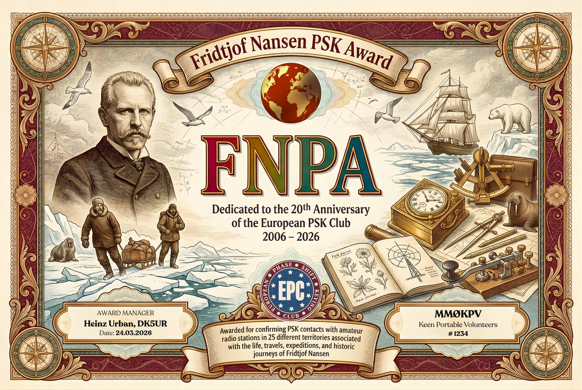
Applicants should submit an ADIF log showing PSK QSOs from any 25 different valid territories out of the 51 listed below. For reliable checking, each claimed QSO should carry the territory reference in the COMMENT field, for example #FNPA FN-01 ... #FNPA FN-51.
- The FNPA may be claimed by any licensed radio amateur, club station, or eligible SWL / DMS operator under the applicable EPC general rules.
- All operation must comply with the operator’s licence conditions and the relevant award framework.
- The applicant must provide evidence of having contacted amateur radio stations from any 25 different valid FNPA territories listed in the table below.
- The valid list contains 51 territories in total.
- Each territory counts only once toward qualification.
- Contacts must be documented in ADIF format.
- It is recommended that the applicant uses the COMMENT field in the format #FNPA FN-01 ... #FNPA FN-51 to identify the claimed territory clearly.
- Only PSK contacts are valid for this award.
- Any PSK variant and any baud rate may be used.
- Credit is valid on amateur bands below 54 MHz.
- Mixed-band submissions are permitted.
- This award is based on a defined FNPA territory list rather than on DXCC entities alone.
- The list combines modern administrative units, islands, archipelagos, river sectors, peninsulas, straits, polar drift sectors and mission centers that are materially connected to Fridtjof Nansen’s life.
- Russian Arctic and Siberian entries have been expanded to reflect the route geography more closely, including the Kara Sea gateway, island groups, Yenisei sectors and the Krasnoyarsk-to-Vladivostok Trans-Siberian sequence.
- The displayed notation follows the user preference of writing Ø instead of numerical zero in prefixes such as RØ.
| Prefix | Territory | FNPA Code | Modern Type | How it relates to Fridtjof Nansen |
|---|---|---|---|---|
| LA | Oslo, Norway | FN-01 | County / Capital City | Birthplace at Store Frøen and the city of his university years in Christiania/Oslo. |
| LA | Akershus / Bærum, Norway | FN-02 | County / Municipality | His best-known home district: Lysaker and later Polhøgda in Bærum were his main family bases. |
| LA | Vestland / Bergen, Norway | FN-03 | County / City | Nansen worked at Bergen Museum here and developed much of the scientific background to the Greenland crossing. |
| LA | Finnmark / Vardø, Norway | FN-04 | County / Town | Fram’s last Norwegian port in 1893 and the place where Nansen and Johansen re-entered Norway in 1896. |
| LA | Troms / Tromsø, Norway | FN-05 | County / City | Fram returned to Tromsø in August 1896 after the drift, where Nansen rejoined the expedition. |
| JW | Svalbard, Norway | FN-06 | Archipelago | Nansen’s 1882 sealing voyage operated in the Greenland–Spitsbergen waters, and Fram later emerged in the Svalbard approach sector. |
| JW | Spitsbergen, Svalbard | FN-07 | Island | The drift of Fram ended in the waters off Spitsbergen before the ship returned to Tromsø. |
| JW | Bjørnøya / Bear Island, Svalbard | FN-08 | Island | Bear Island is a key Barents Sea waypoint on the western approach to Nansen’s Arctic routes. |
| OX | Kujalleq / Umivik District, Greenland | FN-09 | Municipality / Coastal District | Modern municipality containing the Umivik area where Nansen’s 1888 Greenland party made its difficult east-coast landing. |
| OX | Sermersooq / Nuuk (Godthåb), Greenland | FN-10 | Municipality / City | Nansen wintered at Godthåb/Nuuk after completing the first crossing of Greenland. |
| OX | Greenland Ice Sheet | FN-11 | Inland Ice Sheet | The first east-to-west crossing of the Greenland Ice Sheet was one of Nansen’s defining achievements. |
| OX | East Greenland Pack-Ice Coast | FN-12 | Polar Coastal Sector | Nansen first saw Greenland from Viking in 1882 and later fought through the east-coast ice during the 1888 crossing. |
| RI1/R1 | Barents Sea | FN-13 | Arctic Sea | The main western Arctic sea approach on the Fram expedition and on the 1882 sealing voyage. |
| RI1/R1 | Arctic Ocean Transpolar Drift Zone | FN-14 | Central Polar Drift Sector | The whole core idea of the Fram expedition was to freeze the ship into this drift and let the ice carry it westward. |
| RI1/RIØ | High Arctic Pack-Ice / Farthest North Sector | FN-15 | Polar Ice Sector | Nansen and Johansen travelled over the high Arctic pack and reached 86°13.6′ N, his famous Farthest North. |
| RI1O | Arkhangelsk Oblast / Novaya Zemlya, Russia | FN-16 | Oblast / Archipelago | Fram’s eastward route from Vardø to the Siberian coast ran along the Novaya Zemlya gateway into the Kara Sea. |
| RI1P | Nenets Autonomous Okrug / Vaigach Island, Russia | FN-17 | Autonomous Okrug / Island | The route into the Kara Sea passed the Vaigach–Yugorsky Shar gateway, an important modern island unit on the map comparison. |
| R1P | Nenets Autonomous Okrug / Yugorsky Shar – Khabarovo Sector, Yugorsky Peninsula, Russia | FN-18 | Strait / Coastal Sector | The Khabarovo area at the Yugorsky Shar sea gate belongs to the route corridor between the Barents and Kara seas. |
| R9K | Yamalo-Nenets Autonomous Okrug / Yamal Peninsula, Russia | FN-19 | Autonomous Okrug / Peninsula | Nansen’s 1913 Kara Sea route into Siberia passed the western Siberian Arctic coast opposite the Yamal sector. |
| RI9/RIØ | Kara Sea | FN-20 | Arctic Sea | Central both to Fram’s 1893 approach and to Nansen’s 1913 commercial-route investigation with Jonas Lied. |
| RIØB | Krasnoyarsk Krai / Dikson Island, Russia | FN-21 | Krai / Island | The Yenisei gateway at Dikson was a major Arctic entry point on Nansen’s 1913 Siberian journey. |
| RIØB | Krasnoyarsk Krai / Yenisei Gulf, Russia | FN-22 | Krai / Gulf | From the Kara Sea the 1913 voyage entered the Yenisei estuary system through the Yenisei Gulf. |
| RØB | Krasnoyarsk Krai / Lower Yenisei – Dudinka Sector, Taymyrsky Dolgano-Nenetsky District, Russia | FN-23 | Krai / River Sector | Nansen continued south by steamer up the lower Yenisei through the Dudinka region. |
| RØA | Krasnoyarsk Krai / Central Yenisei – Turukhansky District, Russia | FN-24 | Krai / District / River Sector | His 1913 river journey then continued through the central Yenisei interior on the way to Krasnoyarsk. |
| RØA | Krasnoyarsk Krai / Krasnoyarsk, Russia | FN-25 | Krai / City | He reached Krasnoyarsk before taking the Trans-Siberian Railway eastward. |
| RØB | Krasnoyarsk Krai / Taymyr Peninsula, Taymyrsky Dolgano-Nenetsky District, Russia | FN-26 | Krai / Peninsula | Fram’s drift-route approach crossed the great Taymyr Peninsula sector in the high Arctic. |
| RØB | Krasnoyarsk Krai / Cape Chelyuskin, Taymyrsky Dolgano-Nenetsky District, Russia | FN-27 | Krai / Cape | Cape Chelyuskin, the northern tip of mainland Eurasia, is one of the fixed landmarks on the Fram route map. |
| RIØB | Krasnoyarsk Krai / Sverdrup Island (Kara Sea), Taymyrsky Dolgano-Nenetsky District, Russia | FN-28 | Krai / Island | Sverdrup Island in the Kara Sea is one of the specific Russian islands marked on classic maps of the expedition route. |
| RØQ | Sakha Republic / Olenyok Coast, Russia | FN-29 | Republic / Arctic Coastal Sector | The eastbound Arctic route continued along the Olenyok coast shown on the expedition map. |
| RIØQ | Laptev Sea | FN-30 | Arctic Sea | Fram’s route along the north coast of Siberia crossed the Laptev Sea before turning north near the New Siberian Islands. |
| RIØQ | Sakha Republic / New Siberian Islands, Russia | FN-31 | Republic / archipelago | Near the New Siberian Islands Fram was frozen into the pack to begin the transpolar drift. |
| RI1FJ | Franz Josef Land, Russia | FN-32 | Arctic Archipelago | The Nansen–Johansen retreat ended in Franz Josef Land, a core territory in the expedition story. |
| RI1FJ | Jackson Island, Franz Josef Land | FN-33 | Island | Nansen and Johansen wintered in a hut on Jackson Island during 1895–96. |
| RI1FJ | Northbrook Island / Cape Flora, Franz Josef Land | FN-34 | Island / cape | At Cape Flora on Northbrook Island Nansen met Frederick Jackson, a chance encounter that secured rescue. |
| RI1FJ | Rudolf Island / Cape Fligely Area, Franz Josef Land | FN-35 | Island / Far-North Cape sector | The retreat brought Nansen near the far northern part of Franz Josef Land in the Rudolf Island / Cape Fligely sector. |
| G | London / England, United Kingdom | FN-36 | Capital City / Country Division | Nansen served as Norway’s minister to the United Kingdom in London from 1906 to 1908. |
| K3 | District of Columbia, USA | FN-37 | Federal District | Washington was the base of Nansen’s 1917–18 negotiations over Norwegian shipping and food supply during World War I. |
| HB9 | Geneva Canton, Switzerland | FN-38 | Canton | Geneva was central to Nansen’s League of Nations refugee work and the creation of the Nansen passport. |
| F | Île-de-France / Paris, France | FN-39 | Region / Capital City | Nansen was active at the Paris Peace Conference in 1919. |
| YL | Riga, Latvia | FN-40 | Capital Region / City | Riga was one of the first centers of Nansen’s 1921 famine-relief negotiations with Soviet representatives. |
| R3A | Moscow, Russia | FN-41 | Federal City | Moscow was another key location in his 1921 famine-relief diplomacy. |
| TA1 | İstanbul, Türkiye | FN-42 | Province / Metropolitan City | Constantinople/Istanbul became central to Nansen’s refugee work after the Greco-Turkish catastrophe. |
| EK | Yerevan, Armenia | FN-43 | Province-Equivalent City | Nansen worked for Armenian refugee resettlement and visited the Yerevan area in connection with this work. |
| EK | Shirak, Armenia | FN-44 | Province | The Shirak / Alexandropol-Gyumri area belonged to the Armenian relief sphere closely associated with his post-war missions. |
| RØS | Irkutsk Oblast, Russia | FN-45 | Oblast | Part of the eastbound Trans-Siberian route from Krasnoyarsk to Vladivostok. |
| RØO | Republic of Buryatia, Russia | FN-46 | Republic | Nansen crossed Buryatia on the Trans-Siberian line east of Lake Baikal. |
| RØU | Zabaykalsky Krai, Russia | FN-47 | Krai | Another major east-Siberian territory crossed on the Trans-Siberian Railway. |
| RØJ | Amur Oblast, Russia | FN-48 | Oblast | The eastbound railway route continued through the Amur basin. |
| RØD | Jewish Autonomous Oblast, Russia | FN-49 | Autonomous Oblast | The Trans-Siberian line passes through today’s Jewish Autonomous Oblast before reaching Khabarovsk Krai. |
| RØC | Khabarovsk Krai, Russia | FN-50 | Krai | A major Far Eastern territory on the final overland approach to Vladivostok. |
| RØL | Primorsky Krai / Vladivostok, Russia | FN-51 | Krai / City | Nansen’s 1913 trans-Siberian journey ended at Vladivostok on the Pacific coast. |
Note: Qualification for the FNPA is based only on working 25 different territories from the valid FNPA list above. The list is deliberately broader than a simple biography summary: it includes homes, Greenland, the inland ice, sea and drift sectors, the detailed Russian Arctic / Yenisei / Trans-Siberian route, Franz Josef Land sub-territories, and the best-documented diplomatic and humanitarian centers of Nansen’s later life.
