
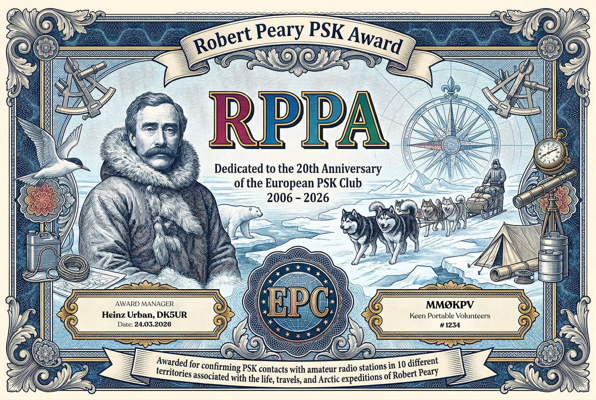
THE AWARD IS BASED ON THE DOCUMENTED LIFE, ARCTIC BASES, ROUTE GEOGRAPHY AND POLAR JOURNEYS OF ROBERT E. PEARY
The RPPA translates the geography of Robert Peary’s life into a practical modern award list for radio amateurs. The list follows his birth and home territories, major Atlantic staging ports, Labrador and Greenland coastal stops, Inuit contact zones, Ellesmere Island bases, named capes and islands on the Canadian side, and the drifting polar-ice sectors associated with his attempts toward the North Pole.
Qualification is based on the defined RPPA territory table below. In several high-Arctic areas, especially the polar pack ice and the North Pole row, one practical amateur prefix may necessarily cover more than one geographic territory. For that reason, award credit is determined by the RPPA territory reference code in the applicant’s ADIF file, not by prefix uniqueness alone.
To qualify, the applicant must submit an ADIF log showing PSK QSOs with amateur radio stations from any 10 different valid RPPA territories out of the 41 territories listed below. It is a mandatory requirement that each claimed QSO carries the matching territory reference in the COMMENT field, for example #RPPA RP-01 ... #RPPA RP-41.
Important polar note: RP-41 North Pole (claimed) is explicitly included because the 1909 North Pole claim is central to Peary’s life story, while the award text also makes clear that the claim remains historically disputed.
- The RPPA may be claimed by any licensed radio amateur, club station, or eligible SWL / DMS operator under the applicable EPC general rules.
- All operation must comply with the operator’s licence conditions and the relevant award framework.
- The applicant must provide evidence of having contacted amateur radio stations from any 10 different valid RPPA territories listed in the table below.
- The valid list contains 41 territories in total.
- Each territory counts only once toward qualification.
- Contacts must be documented in ADIF format.
- It is a mandatory requirement that the applicant adds territory references in the COMMENT field of the ADIF file in the format #RPPA RP-01 ... #RPPA RP-41, so that award processing software can identify the claimed territory correctly.
- Only PSK contacts are valid for this award.
- Any PSK variant and any baud rate may be used.
- Credit is valid on amateur bands below 54 MHz.
- Mixed-band submissions are permitted.
- This award is based on a defined RPPA territory list rather than on DXCC entities alone.
- The list combines modern administrative units, islands, bays, fjords, capes, straits and polar drift sectors that are materially connected to Robert Peary’s life or expeditions.
- For normal inhabited regions, the table shows the practical amateur-radio prefix associated with that province, state, territory or national allocation.
- For drifting-ice rows and the North Pole row, there is no permanent civil prefix of their own. The table therefore uses the nearest practical award prefix reference from the Canadian–Greenland high Arctic, while qualification is controlled by the RPPA code.
- The displayed notation follows the user preference of writing Ø instead of numerical zero in prefixes such as VYØ.
| Prefix | Territory | RPPA Code | Modern Type | How it relates to Robert Peary |
|---|---|---|---|---|
| K3 | Cambria County, Pennsylvania, USA | RP-01 | County | Birth territory: Robert Edwin Peary was born at Cresson in Cambria County on 6 May 1856. |
| K1 | Cumberland County, Maine, USA | RP-02 | County | Peary was raised in southern Maine, attended school in Portland, studied at Bowdoin in Brunswick, and later retired at Eagle Island in Harpswell, all in Cumberland County. |
| K1 | Oxford County, Maine, USA | RP-03 | County | After college he lived in Fryeburg for a period and carried out local survey work there. |
| K3 | District of Columbia, USA | RP-04 | Federal district | Washington, D.C. was Peary’s long professional base with the U.S. Navy, and it is also where he died in 1920. |
| K2 | New York, USA | RP-05 | State | Brooklyn and New York were major organizing and departure points for several of his Arctic expeditions and for the Cape York meteorite work. |
| K1 | Massachusetts, USA | RP-06 | State | Boston appears in the 1893 expedition route as one of the documented East Coast departure stages before the Labrador–Greenland run. |
| VE1 | Nova Scotia, Canada | RP-07 | Province | Sydney, Nova Scotia was a major coaling and departure port for the Roosevelt expeditions in 1898, 1905 and 1908. |
| VO1 | Newfoundland (island), Canada | RP-08 | Island / province sector | St. John’s on the island of Newfoundland appears as a documented coaling stop on the 1893 voyage north. |
| VO2 | Labrador, Canada | RP-09 | Mainland region | The Labrador coast was used repeatedly on Peary’s Arctic routes, especially during the 1893 voyage north. |
| VO2 | Hopedale, Nunatsiavut, Labrador, Canada | RP-10 | Community / regional coast sector | Hopedale was a documented stop on the 1893 expedition, visited while moving north along the Labrador coast. |
| VO2 | Okkak, Nunatsiavut, Labrador, Canada | RP-11 | Historic mission station / regional coast sector | Okkak was another explicitly documented 1893 stop where Peary gathered information and continued north. |
| VO1/VO2 | Strait of Belle Isle, Canada | RP-12 | Strait | The Strait of Belle Isle appears in Peary’s 1891 and 1893 outward routes between Newfoundland and Labrador. |
| OX | Qeqqata Municipality, Greenland | RP-13 | Municipality | Peary’s later west-Greenland route included Holsteinsborg (Sisimiut) and Sukkertoppen (Maniitsoq), both in modern Qeqqata. |
| OX | Qeqertalik Municipality, Greenland | RP-14 | Municipality | Godhavn/Qeqertarsuaq, one of Peary’s most important Greenland staging points, lies in modern Qeqertalik. |
| OX | Disko Island, Greenland | RP-15 | Island | Peary landed at Godhavn on Disko Island during his 1886 Greenland journey and returned there on later voyages. |
| OX | Avannaata Municipality – Upernavik district, Greenland | RP-16 | Municipality / district sector | Upernavik appears on the 1893 voyage north and represents Peary’s transition from central west Greenland to the far north. |
| OX | Duck Islands, south Melville Bay, Greenland | RP-17 | Island group | The Duck Islands at the southern edge of Melville Bay were repeatedly visited as a hunting and staging point on Peary’s northbound voyages. |
| OX | Melville Bay, Greenland | RP-18 | Bay / ice-navigation sector | Melville Bay was one of the major dangerous pack-ice barriers on Peary’s route toward northwest Greenland. |
| OX | McCormick Bay / Red Cliff, Greenland | RP-19 | Bay / expedition base sector | Red Cliff in McCormick Bay was the base for the 1891–92 expedition and the starting point of the White March. |
| OX | North Star Bay / Wolstenholme Fjord, Greenland | RP-20 | Bay / fjord sector | This bay–fjord system formed the broader gateway to Etah and the far-north Greenland operations. |
| OX | Etah, Greenland | RP-21 | Settlement / expedition base | Etah was one of Peary’s most important high-Arctic bases and the last Greenland link before the Ellesmere crossings. |
| OX | Cape York / Savissivik area, Greenland | RP-22 | Cape / settlement sector | Cape York and nearby Savissivik were central to Peary’s work with the Inuit of northwest Greenland and to the meteorite expeditions. |
| OX | Meteorite Island / Saviksoah area, Greenland | RP-23 | Island / locality sector | Peary’s removal of the famous Cape York meteorites is tied to the Meteorite Island–Saviksoah area. |
| OX | Petermann Fjord, Greenland | RP-24 | Fjord | Petermann Fjord appears in the documented 1892 and 1895 inland-travel narratives on the Greenland side of Smith Sound. |
| OX | Independence Fjord / Navy Cliff, Greenland | RP-25 | Fjord / cliff sector | In 1892 Peary and Astrup reached Navy Cliff at Independence Fjord, proving that Greenland was an island. |
| OX | Peary Land / Cape Morris Jesup, Greenland | RP-26 | Polar land sector / cape | Peary later reached Greenland’s far north and identified Cape Morris Jesup, one of the major landmarks of his Arctic career. |
| VYØ | Ellesmere Island, Nunavut, Canada | RP-27 | Island | Ellesmere Island was the Canadian heart of Peary’s later pole expeditions and the landmass from which he pushed farthest north. |
| VYØ | Bache Peninsula, Nunavut, Canada | RP-28 | Peninsula | The Bache Peninsula served as a southern sub-base area on the 1905–06 expedition and part of the approach to Fort Conger. |
| VYØ | Pim Island / Fort Conger, Nunavut, Canada | RP-29 | Island / expedition station | Fort Conger on Pim Island was one of Peary’s principal Arctic bases during the 1898–1902 campaign. |
| VYØ | Cape D’Urville, Nunavut, Canada | RP-30 | Cape | Cape D’Urville appears in the official Bowdoin route sequence for the 1898–1902 expedition. |
| VYØ | Cape Defosse, Nunavut, Canada | RP-31 | Cape | Cape Defosse was another named staging point on the same Ellesmere-side route toward Fort Conger. |
| VYØ | Cape Richardson, Nunavut, Canada | RP-32 | Cape | Cape Richardson appears in Peary’s official 1898–1902 route as a working stop during the northward push. |
| VYØ | Crozier Island, Nunavut, Canada | RP-33 | Island | Crozier Island is listed in the 1898–1902 route as part of the difficult ice-foot travel on the Ellesmere approach. |
| VYØ | Cape Hecla, Nunavut, Canada | RP-34 | Cape | Cape Hecla was the launch point for Peary’s 1900 and 1906 pushes onto the polar sea. |
| VYØ | Cape Sheridan, Nunavut, Canada | RP-35 | Cape / expedition base | Cape Sheridan was the winter harbour of the Roosevelt and Peary’s main base on the 1905–06 and 1908–09 expeditions. |
| VYØ | Payer Harbour, Nunavut, Canada | RP-36 | Harbour | Payer Harbour appears in the 1908–09 route sequence during the final approach to the high-Ellesmere base region. |
| VYØ | Lincoln Bay, Nunavut, Canada | RP-37 | Bay | Lincoln Bay appears in the 1908–09 route and belongs to the same Ellesmere north-coast operating sector. |
| VYØ | Cape Columbia, Nunavut, Canada | RP-38 | Cape | Cape Columbia was the start point for Peary’s 1909 northward sledge march toward the Pole. |
| VYØ | Lincoln Sea / polar pack ice north of Ellesmere, Arctic Ocean | RP-39 | Polar sea / drifting ice sector | Peary’s routes from Cape Hecla and Cape Columbia crossed the moving pack ice of the Lincoln Sea north of Ellesmere. |
| VYØ/OX | Central Arctic Ocean drift ice | RP-40 | Drifting sea-ice sector | Beyond the coast, Peary’s polar journeys depended on travel over the mobile central Arctic pack where no permanent land territory exists. |
| VYØ/OX | North Pole (claimed) | RP-41 | Geographic pole | Peary claimed to have reached the Geographic North Pole on 6 April 1909; the claim remains historically disputed, but it is central to his life story. |
Note: Qualification for the RPPA is based only on working 10 different territories from the valid RPPA list above. The title honors Robert E. Peary through the full geography of his life: home counties, Atlantic staging points, Labrador and Greenland coastal approaches, northwest Greenland Inuit and meteorite territories, Ellesmere Island bases and capes, the drifting polar pack ice, and the claimed North Pole destination itself.
